Prolonged Freezing Rain Threatens Icy Start to Week for Parts of Southern Ontario on Monday

NOTE: YOU CAN CLICK ON THE MAP TO OPEN A ZOOMABLE IMAGE

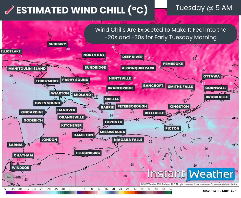
December has kicked off with a cold and snowy start across Southern Ontario, as a significant lake-effect snow squall outbreak blanketed parts of the snowbelt over the past week. This wintry weather was accompanied by the season's first blast of Arctic air, bringing wind chills as low as -20°C.


GOOGLE AD (NOT ENDORSED BY INSTANT WEATHER)

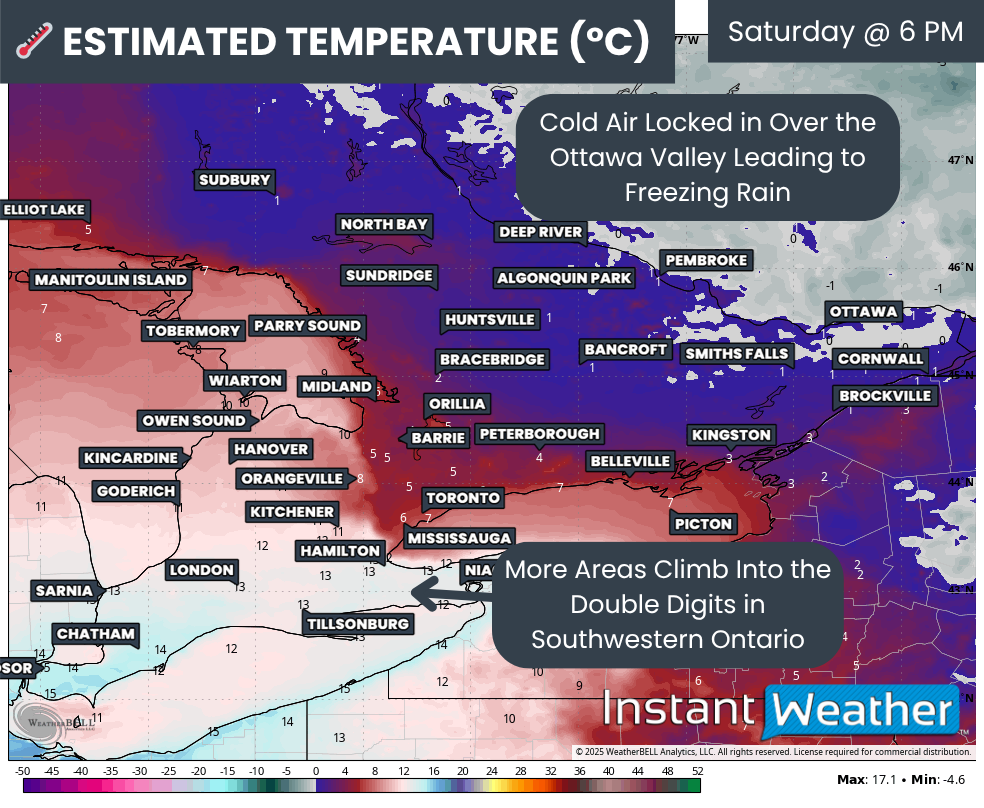
However, a shift in the weather pattern is underway, with milder conditions already spreading into Southwestern Ontario, where Sunday saw daytime highs climbing into the mid to upper single digits.

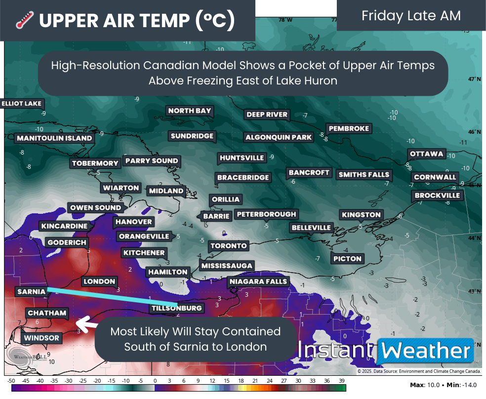
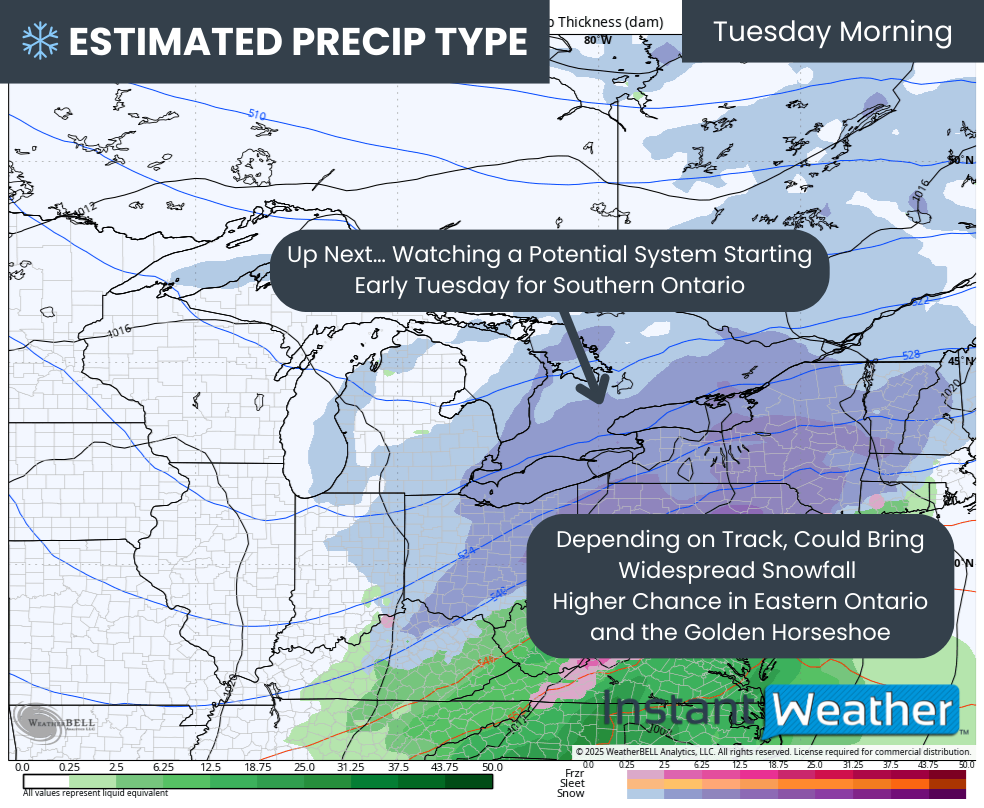
A weather system is expected to arrive early Monday, bringing warmer air aloft, while near-surface temperatures hover around freezing. This setup creates ideal conditions for freezing rain across parts of Central and Eastern Ontario, which, according to the latest data, could last for an extended period.

Freezing rain is expected to begin in the morning hours on Monday, persisting through the afternoon and into the evening. This prolonged event could result in a thin but hazardous layer of ice forming on untreated surfaces such as roads, sidewalks, trees, and power lines, with localized power outages a possibility.


GOOGLE AD (NOT ENDORSED BY INSTANT WEATHER)

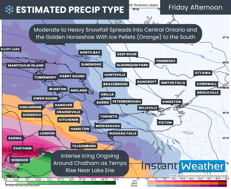
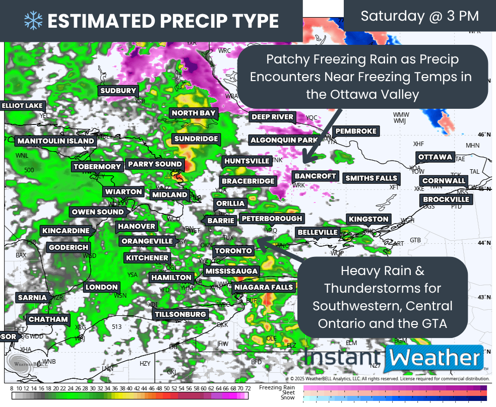
PRECIPITATION TYPE - MAP FROM WEATHERBELL

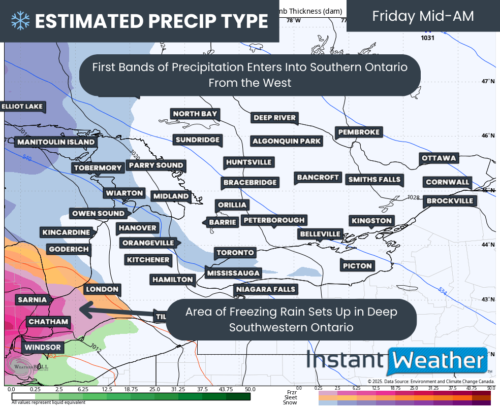
The initial bands of precipitation will move into Deep Southwestern Ontario, including Windsor and London, during the pre-dawn hours on Monday. Temperatures in this region will remain several degrees above freezing throughout the day, so precipitation here is expected to fall as rain.

As the system progresses north and east during the morning, it will encounter below-freezing temperatures near the surface in areas like the Dundalk Highlands (including Orangeville and Shelburne) and parts of the Greater Toronto Area (GTA).


GOOGLE AD (NOT ENDORSED BY INSTANT WEATHER)

This will result in the development of freezing rain, creating a zone stretching from Orangeville eastward through York Region, along the higher elevations of the Oak Ridges Moraine, and into southern portions of Central and Eastern Ontario.

This band of freezing rain is expected to persist into the early afternoon, with locations such as Barrie, Orillia, Kawartha Lakes, Peterborough, and Belleville likely experiencing the heaviest impacts.

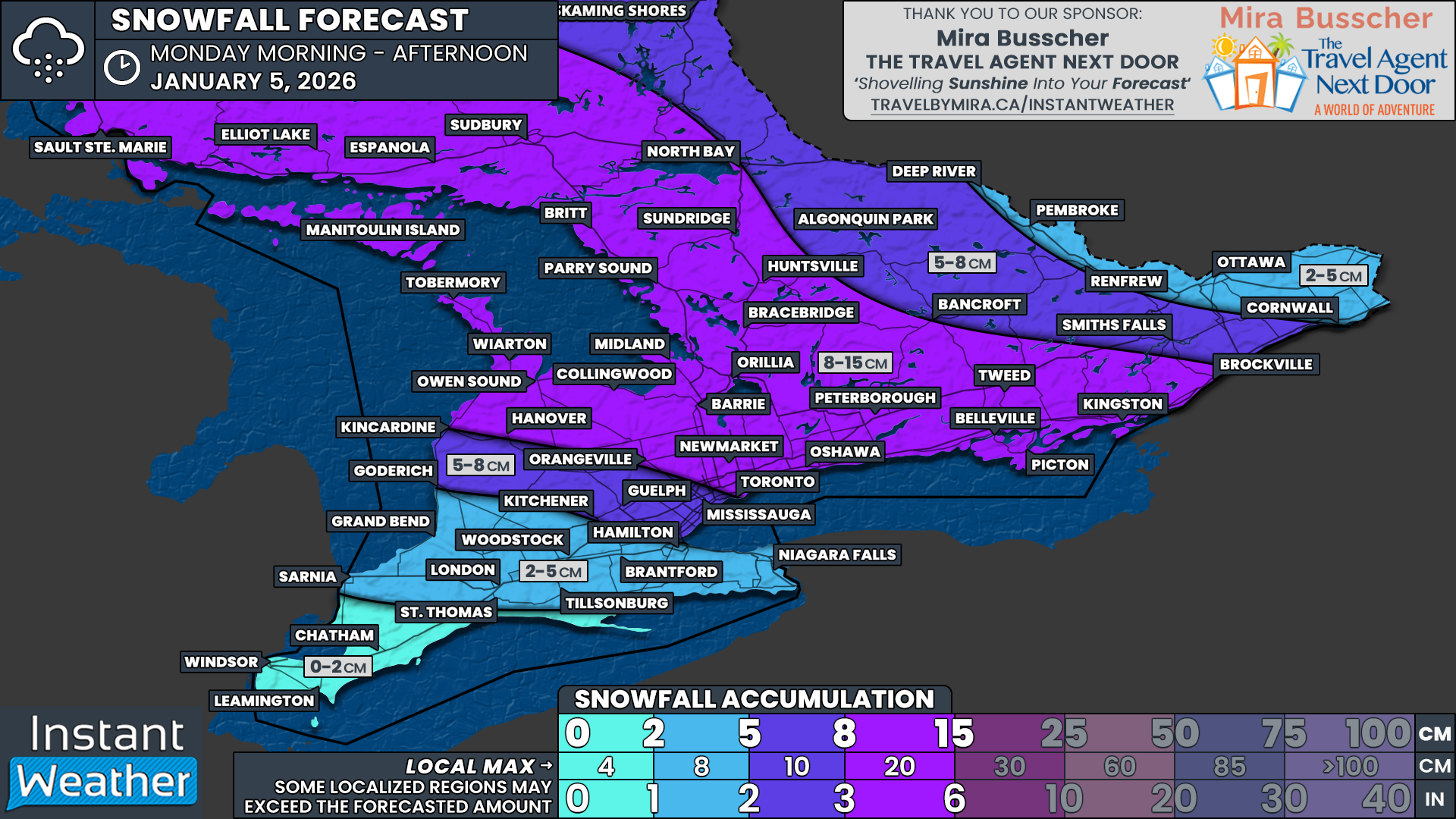
Further north, areas like Muskoka, Bancroft, and the Ottawa Valley are expected to see a mix of wet snow, ice pellets, and freezing rain beginning early Monday afternoon. While significant snowfall accumulation is not expected for Southern Ontario, enough snow could fall to create slushy and slippery road conditions in these areas.


GOOGLE AD (NOT ENDORSED BY INSTANT WEATHER)

PRECIPITATION TYPE - MAP FROM WEATHERBELL

Freezing rain will begin to taper off in the south later in the afternoon, though freezing drizzle may linger into the early evening. Temperatures are forecast to rise slowly above freezing later in the evening and overnight, which should help melt any accumulated ice, albeit gradually.

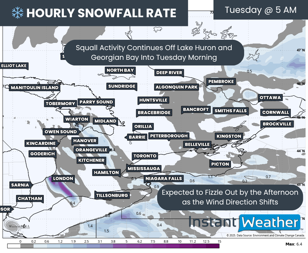
In more northern portions of Central and Eastern Ontario, heavier freezing rain will persist into Monday evening before ending overnight. However, freezing drizzle may continue in the Ottawa Valley into early Tuesday morning, potentially causing icy conditions for the Tuesday morning commute.


GOOGLE AD (NOT ENDORSED BY INSTANT WEATHER)

NOTE: YOU CAN CLICK ON THE MAP TO OPEN A ZOOMABLE IMAGE

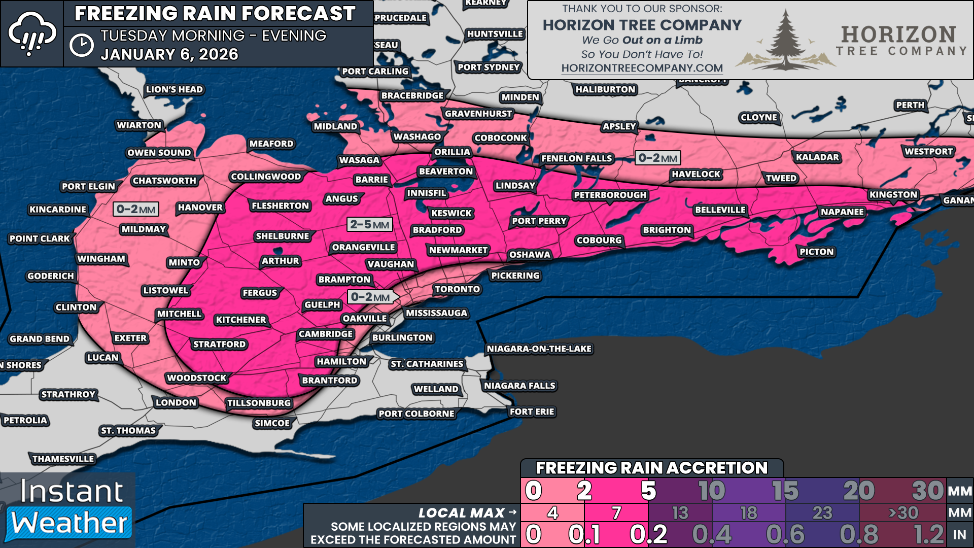
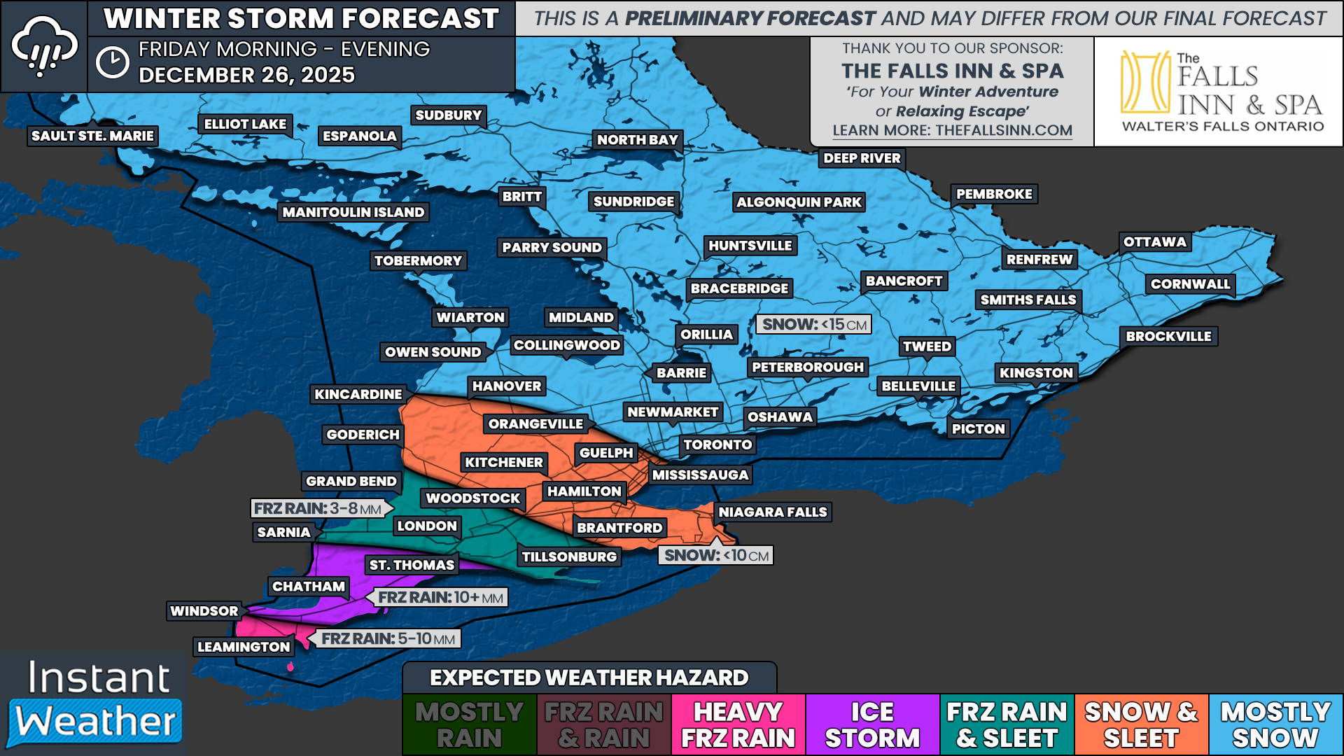
The most significant freezing rain impacts are expected in a narrow corridor extending around Lake Simcoe and eastward along the Lake Ontario shoreline.

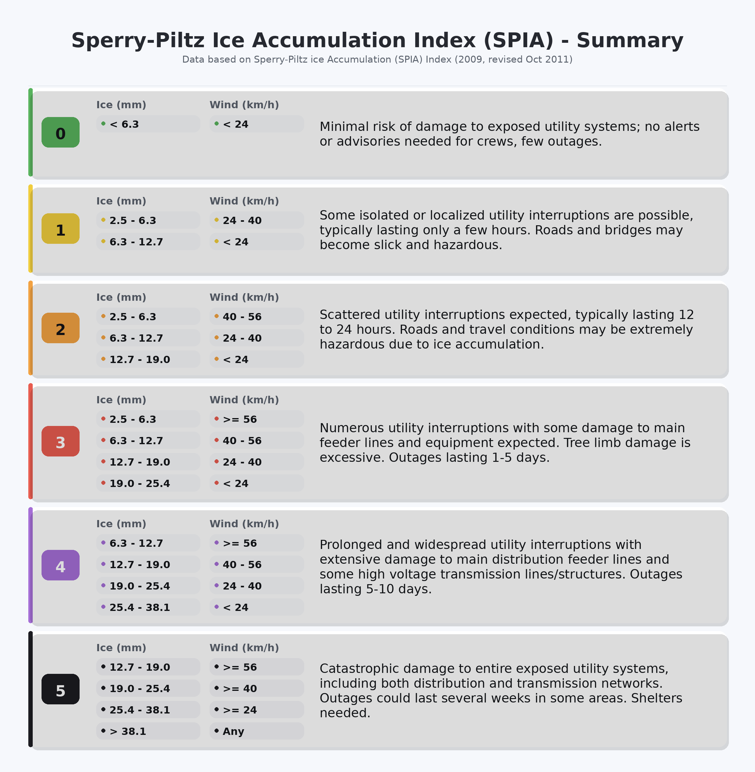
Ice accretion of 2 to 5mm is possible in areas such as Orangeville, Newmarket, Collingwood, Barrie, Orillia, Midland, Bracebridge, Lindsay, Peterborough, Oshawa, Belleville, and Kingston.


GOOGLE AD (NOT ENDORSED BY INSTANT WEATHER)

For the rest of Central and Eastern Ontario, including the Ottawa Valley, up to 2mm of ice accretion is expected, accompanied by ice pellets and a few centimeters of wet snow.

In the GTA, the greatest impacts from freezing rain will likely occur in the northern and eastern portions of the region. Toronto may experience brief freezing rain during the morning hours, but it is expected to transition quickly to rain, especially closer to the lakeshore.

'A Conveyor Belt of Snow’; How Lake Effect Snow Can Bury Entire Towns in a Matter of Days

satellite image of lake effect snow over the Great Lakes, courtesy of the national weather service.

Following the incredible snowfall seen in Sault Ste. Marie and across parts of Muskoka over the weekend, we figured this would be the perfect opportunity to discuss lake effect snow. It’s something that many of us in Ontario have come to expect in the late fall and early winter, especially since we’re surrounded by the Great Lakes.


GOOGLE AD (NOT ENDORSED BY INSTANT WEATHER)

Certain ingredients are required for lake effect snow to occur, but most importantly, there needs to be an unfrozen body of water and a very cold air mass from the Arctic.

In order for lake effect snow to even start to form, there needs to be a temperature difference of at least 13°C between the warm surface of the lake and the 850mb pressure level of the atmosphere (this is typically found at around 1500 metres). The greater the temperature difference, the more unstable the atmosphere becomes and this is often when we see strong convection and the phenomenon known as thundersnow. Without this difference in temperature, lake effect snow simply can not occur. Once this threshold is reached, however, it’s like a switch being flipped and the lake effect snow machine starts.

Another key component in lake effect snow development is moisture. Ideally, the relative humidity at the surface needs to be at least 80% for lake effect snow to form and levels below 70% could actually inhibit development. It can usually be assumed that the lake itself can provide enough moisture, but this is not always true. There also needs to be limited wind shear with height between the surface and the 700mb pressure level so that the moisture is more focused, sort of like a hose. The strongest, most organized bands of lake effect snow develop when the wind shear is less than 30°.

Finally is the concept known as “fetch”. Yes, millennials, we’re trying to make fetch happen. Fetch is the distance that the air mass travels over the lake. Fetch needs to be at least 100km in order for lake effect snow to develop and the greater the fetch, the more snow is produced. When considering prevailing wind directions, the traditional snowbelts are found in areas that are downwind of the greatest possible fetch over the Great Lakes, i.e. Buffalo and the entire length of Lake Erie.

GOOGLE AD (NOT ENDORSED BY INSTANT WEATHER)

The creation of lake Effect Snow. Courtesy of Environment Canada.

When all of these conditions are met, we can see how lake effect snow actually develops.

As the cold air mass travels over the much warmer surface of the lake, the warmth and moisture from the surface is transferred into the lower atmosphere. The warmer, moister air rises and it eventually cools and condenses, forming narrow bands of clouds. These clouds continue to travel over the open lake, gathering even more moisture, until they eventually reach land and the snow starts to fall at rates that can easily exceed 5cm per hour and could even be as high as 20cm per hour! It’s important to note that the hardest hit areas are actually not found immediately at the shoreline, but rather 30-50km inland from the lake.

The direction of the winds dictates which areas are hit by the lake effect snow so as long as the ideal conditions continue, so too will the development and subsequent falling of lake effect snow. This could lead to several days of heavy snow hitting the same area while there are sunny skies less than 20km away. A slight shift in wind direction can quickly change which area gets hit and that makes lake effect snow notoriously tough to forecast.

UPDATE: Squalls on Track to Bury Parts of Ontario’s Snowbelt in Up to 100cm of Snow by Saturday

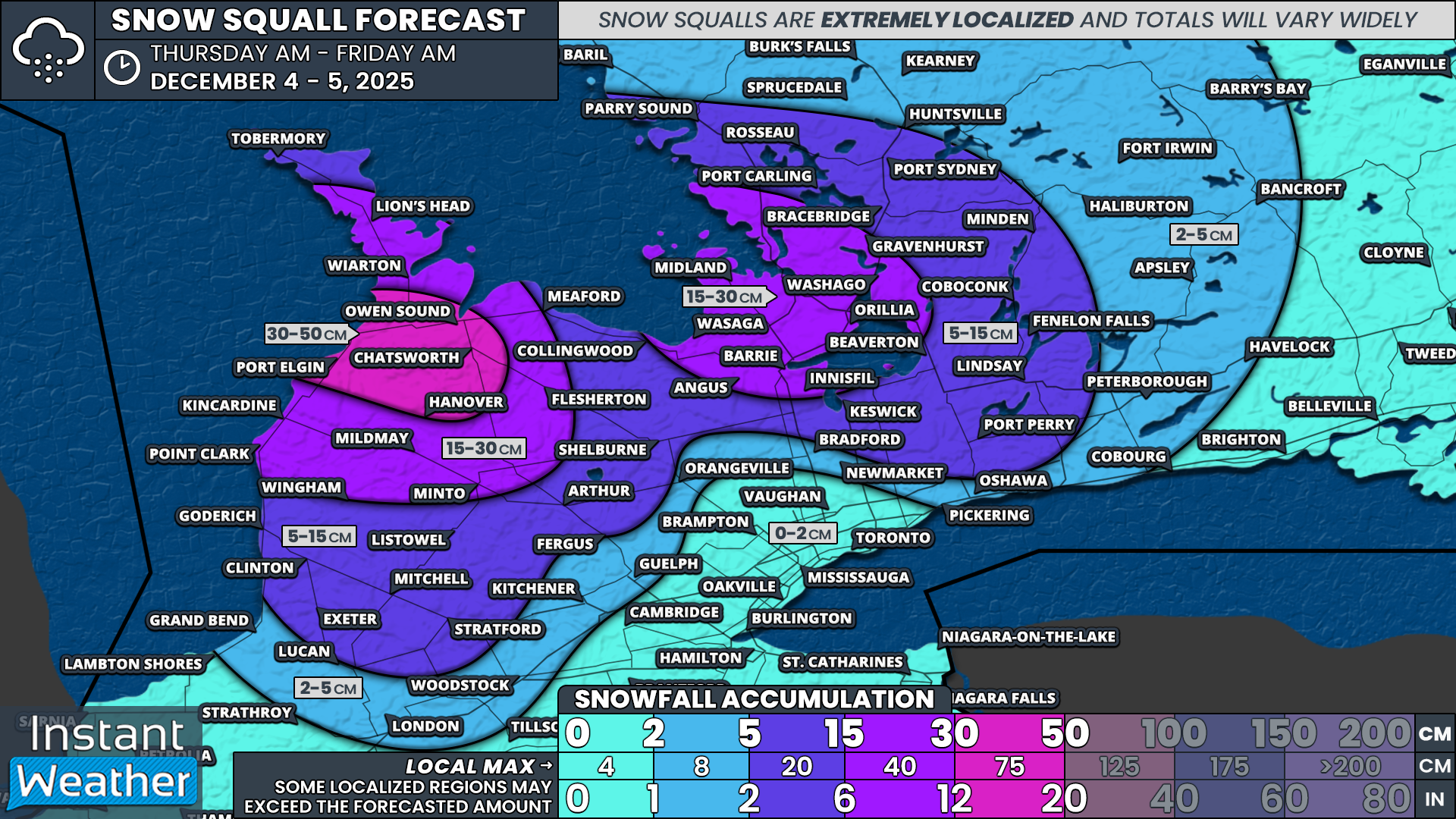
NOTE: YOU CAN CLICK ON THE MAP TO OPEN A ZOOMABLE IMAGE

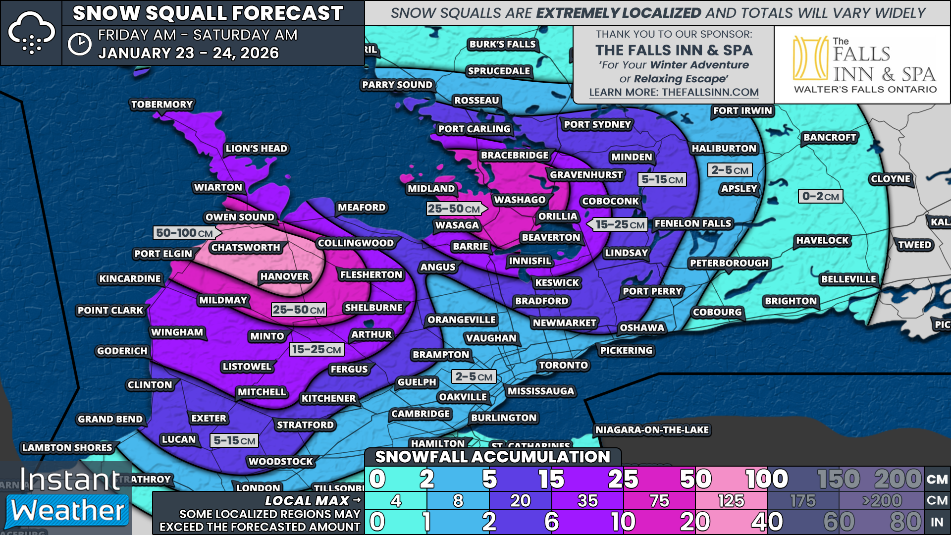
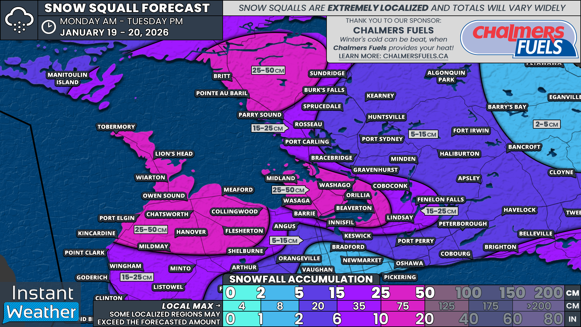
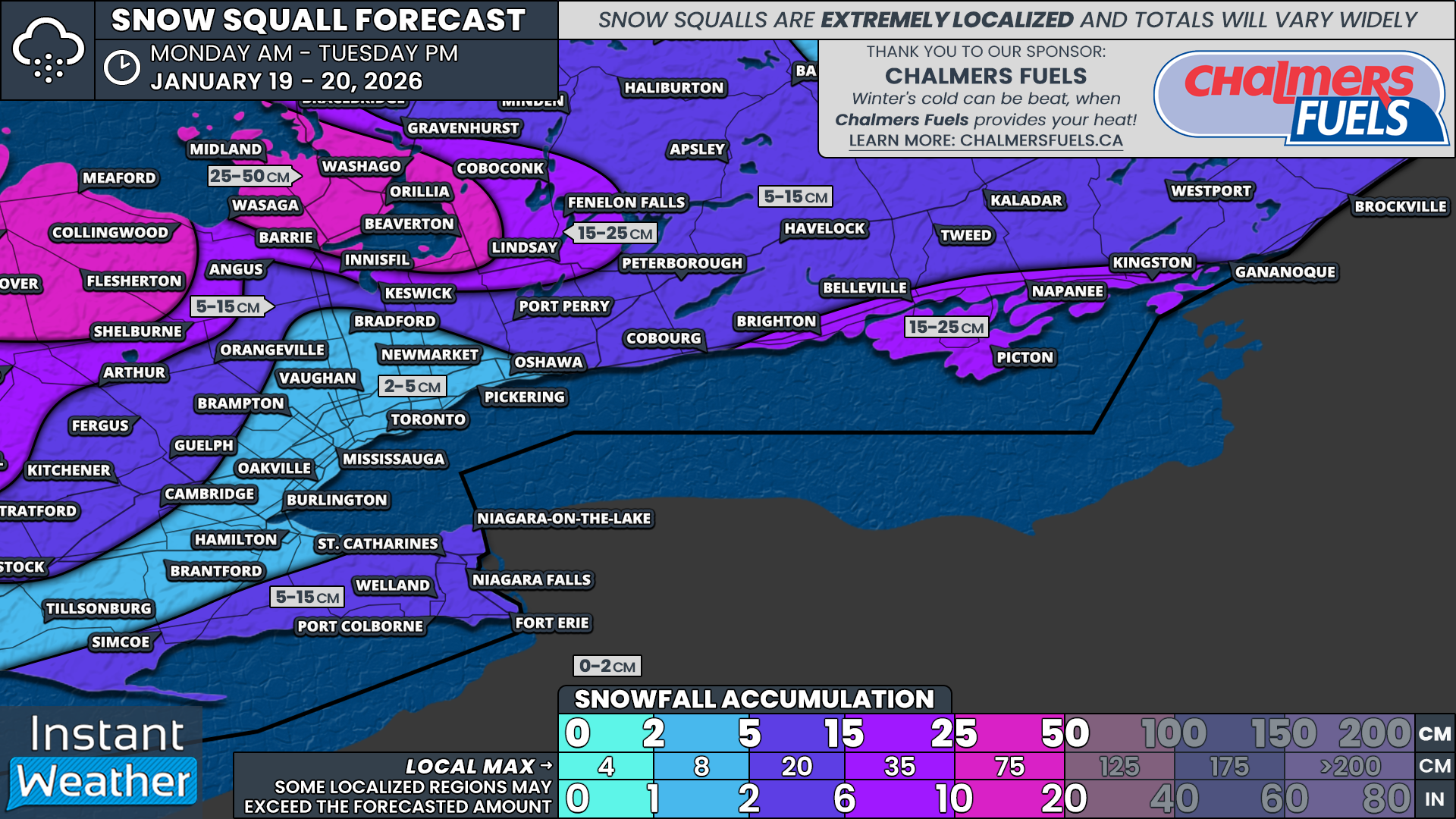
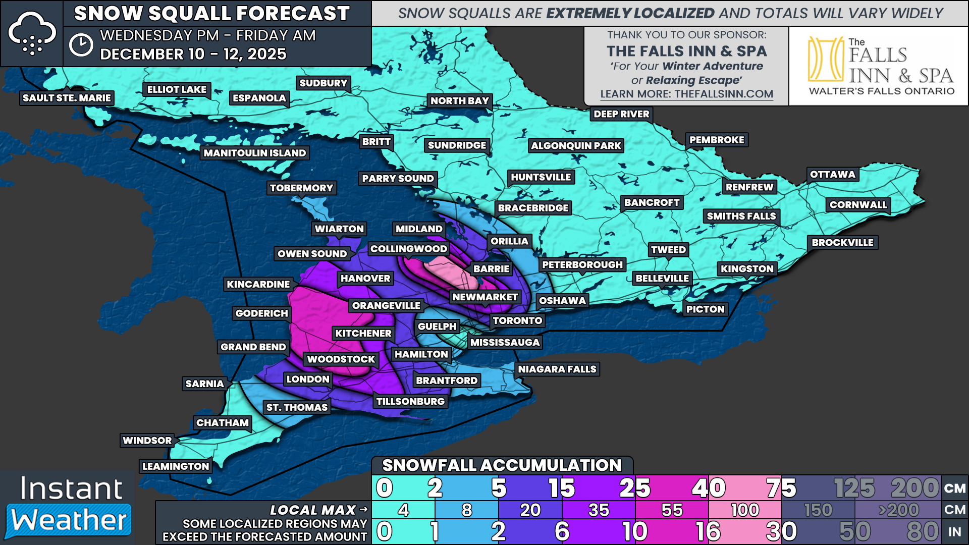
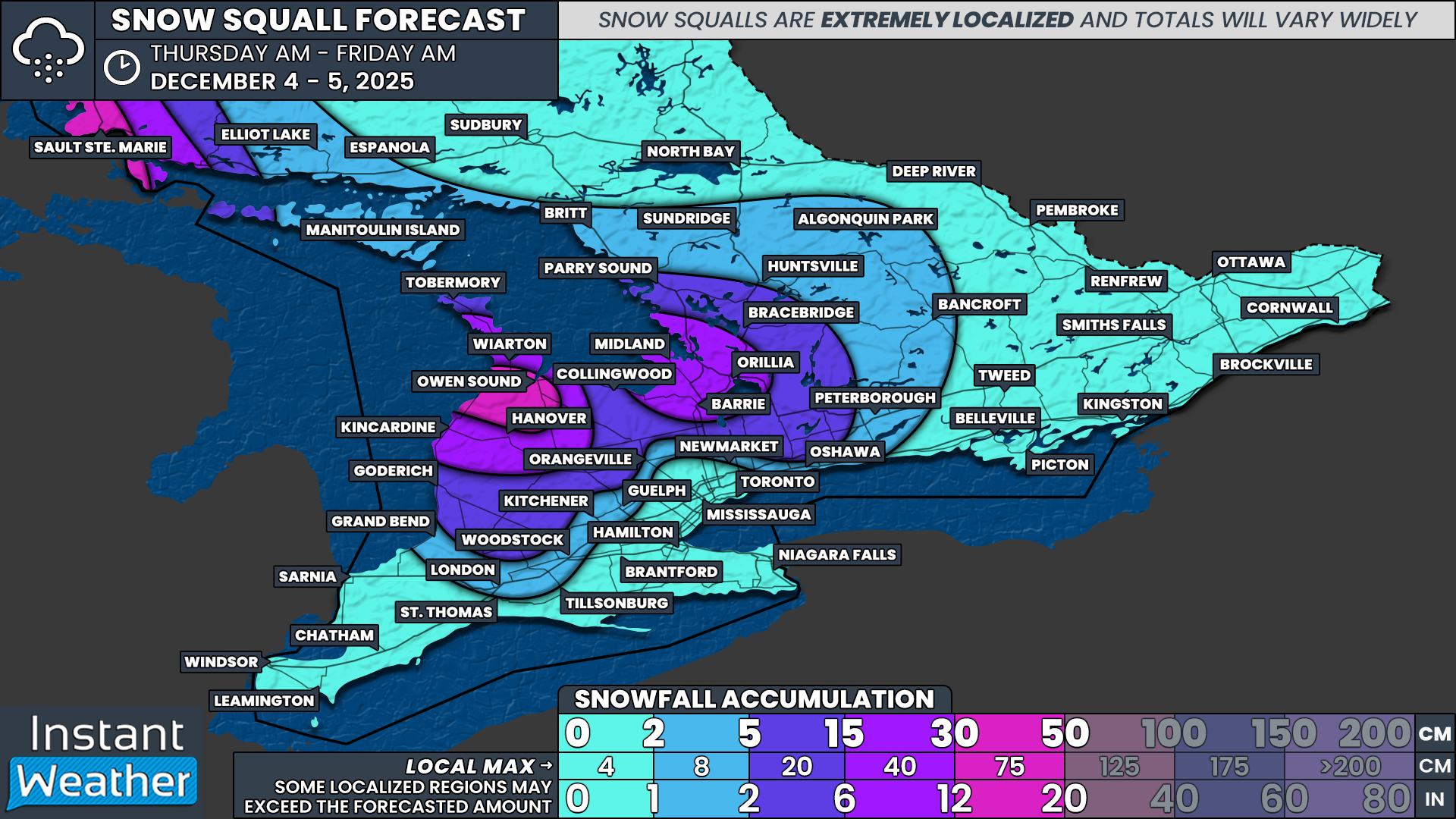
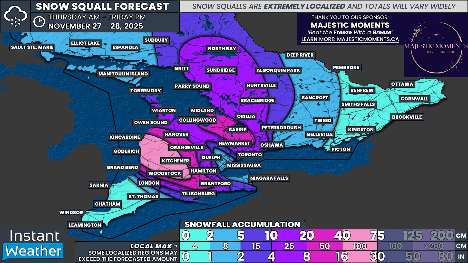
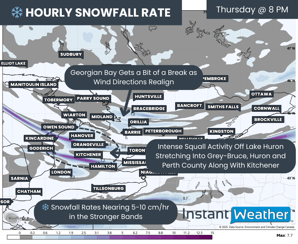
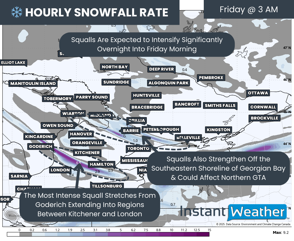
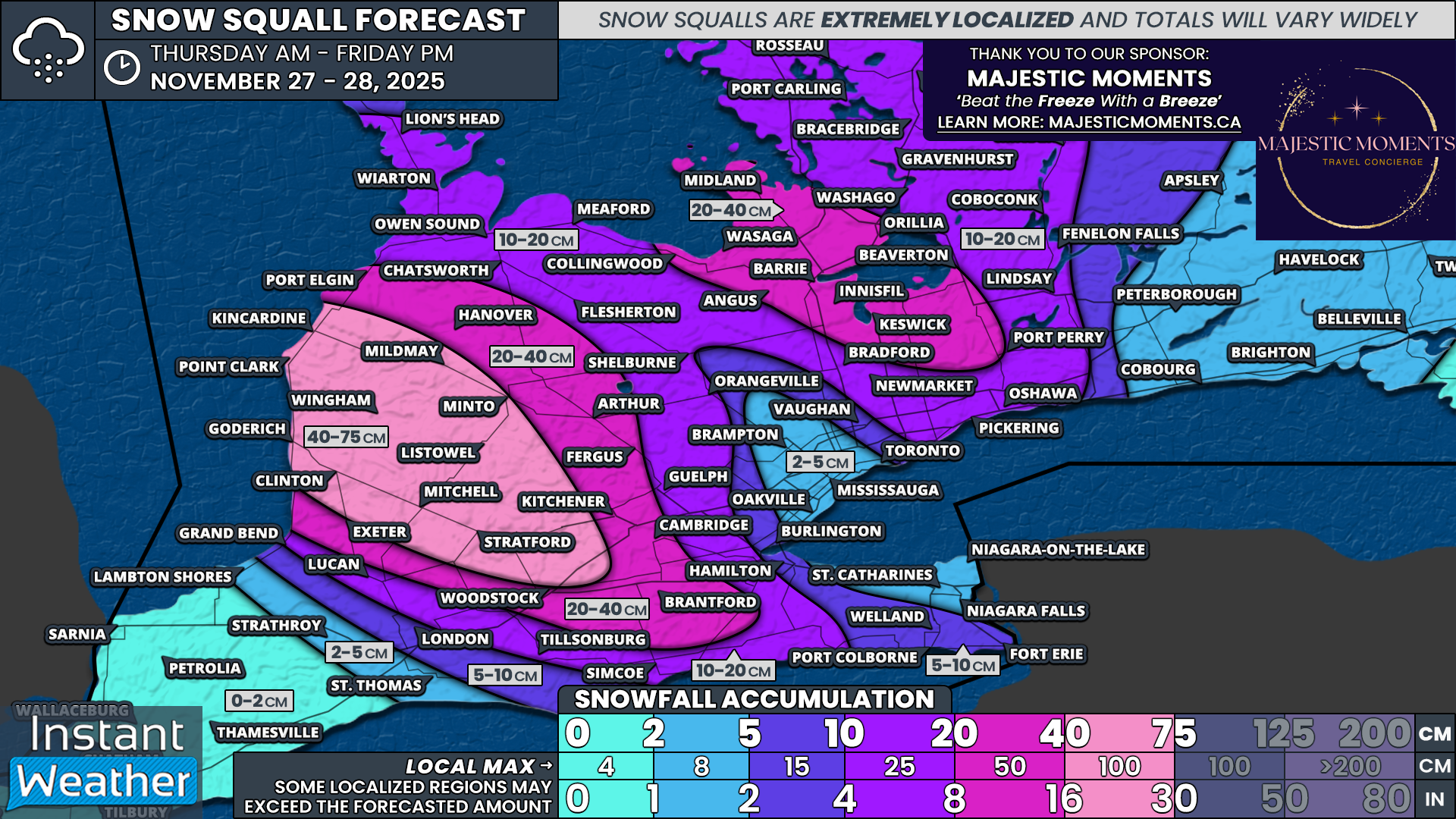
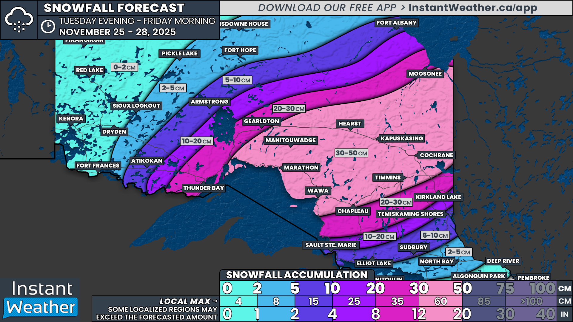
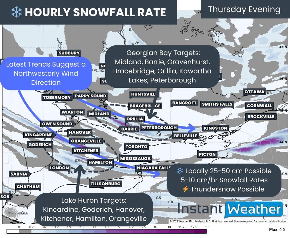
Confidence remains high for a very impactful snow squall event, which began east of Georgian Bay and Lake Huron Thursday evening. By the end of Saturday, some parts of the snowbelt region could be digging out of up to 50 to 100cm of snow!

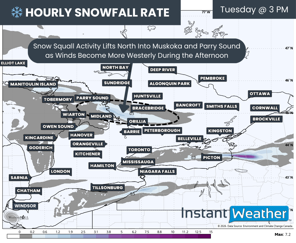
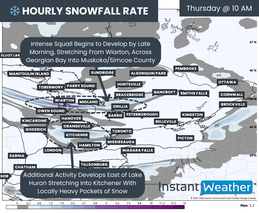
Intense snow squall activity is expected to persist throughout Friday, with two primary squalls forming off Georgian Bay. The southern squall looks to settle between Honey Harbour and MacTier, extending inland toward the Highway 11 corridor from Washago to Bracebridge. This squall may reach as far inland as Haliburton and potentially Bancroft at times.


GOOGLE AD (NOT ENDORSED BY INSTANT WEATHER)

The second squall is projected to stretch across the northern tip of the Bruce Peninsula, coming onshore near Parry Sound. Unlike the southern squall, this one may not push as far inland, meaning Huntsville could see lighter impacts compared to areas like Bracebridge and Gravenhurst.

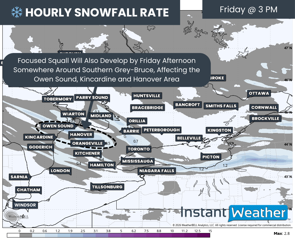
Snow squalls will also persist east of Lake Huron, with the most significant activity setting up just south of Hanover. Higher totals inland can be attributed to colder temperatures in elevated areas, where snow will accumulate more efficiently, compared to the slightly above-freezing conditions closer to the shoreline.


GOOGLE AD (NOT ENDORSED BY INSTANT WEATHER)

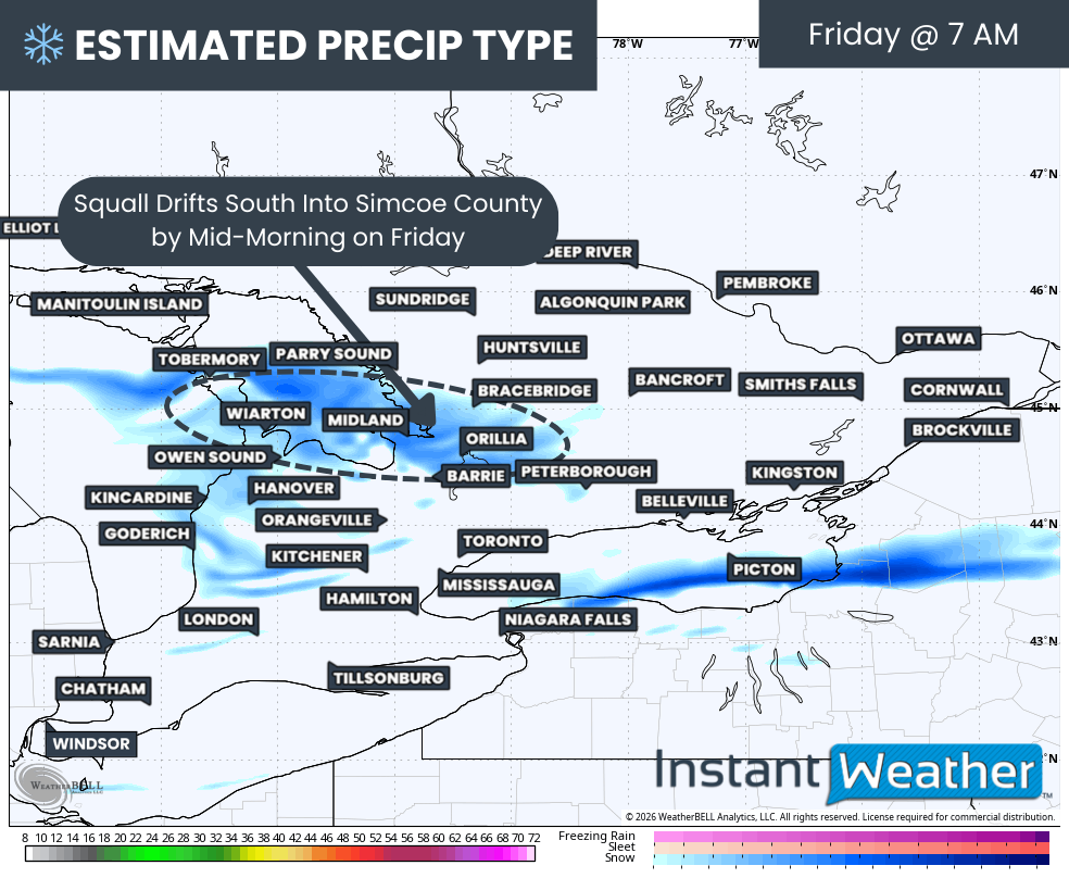
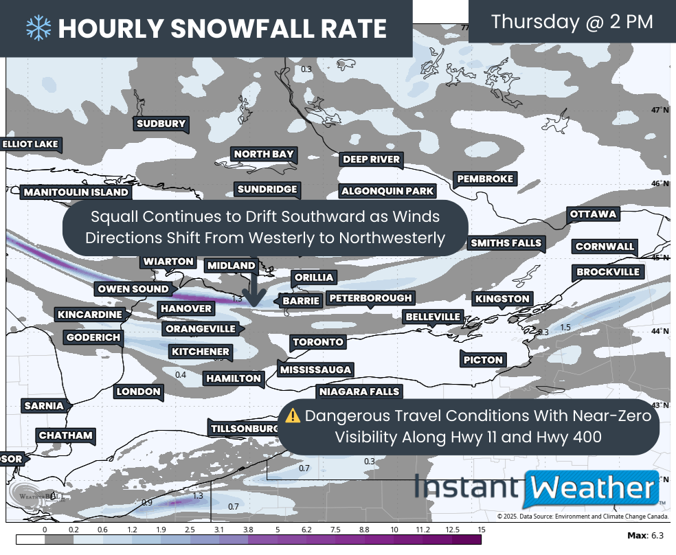
As Friday progresses, models suggest a brief wind shift by the evening, potentially driving the Georgian Bay squall south of Muskoka and into parts of northern Simcoe County.

There is some uncertainty about how far south this squall will drift, but most models suggest it will impact Midland, areas just north of Orillia, and into Rama. Within Orillia, accumulation could vary significantly, with lower totals in the south and much higher amounts in the north, reflecting the sharp gradient shown on our map.


GOOGLE AD (NOT ENDORSED BY INSTANT WEATHER)

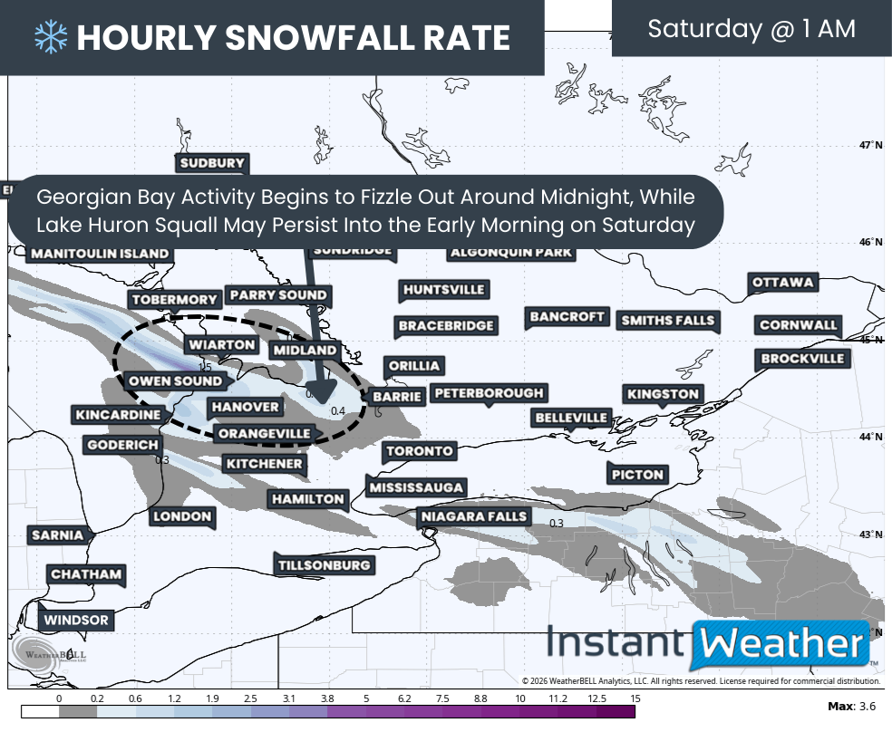
By Saturday morning, the squall is expected to shift back north, realigning across the Parry Sound and Muskoka region. However, this time, it may consolidate into a singular band stretching from Parry Sound into northern Muskoka. This could spare Gravenhurst and Bracebridge from heavy snowfall on a second day, while Huntsville might see more snow as the squall locks into place for much of Saturday.

IMPORTANT

To provide the most accurate information, we are now breaking the snowfall totals into two separate forecasts. This forecast covers Friday and Saturday, while a second forecast will address Sunday and Monday and will be released on Saturday.


GOOGLE AD (NOT ENDORSED BY INSTANT WEATHER)

Our earlier forecast covered the entire four-day period and was intentionally broad to account for a wide range of possibilities. If the snowfall totals for your area are lower than what we initially predicted, it’s likely because your snow will fall later on Sunday or Monday.

As we’ve emphasized in previous updates, snow squalls are notoriously difficult to predict, with sharp gradients between areas of light snow and those with extreme accumulations.


GOOGLE AD (NOT ENDORSED BY INSTANT WEATHER)

In terms of snowfall totals, localized amounts are likely to exceed 50 cm and may even approach 100 cm by the end of Saturday in areas like Parry Sound, Bracebridge, and Gravenhurst. Similar totals are possible for Tobermory and Hanover.

Owen Sound and Collingwood could also experience heavy snow from a Lake Huron streamer, with higher elevations aiding accumulation. These areas could see snowfall ranging from 25 to 50 cm in the most affected zones.


GOOGLE AD (NOT ENDORSED BY INSTANT WEATHER)

Given the tight gradients, snowfall totals will decrease quickly as you move away from the primary snow squalls. Expect 15 to 30 cm across much of Grey-Bruce counties, northern Simcoe County, northern Kawartha Lakes, and Haliburton (excluding the heaviest-hit areas mentioned earlier).

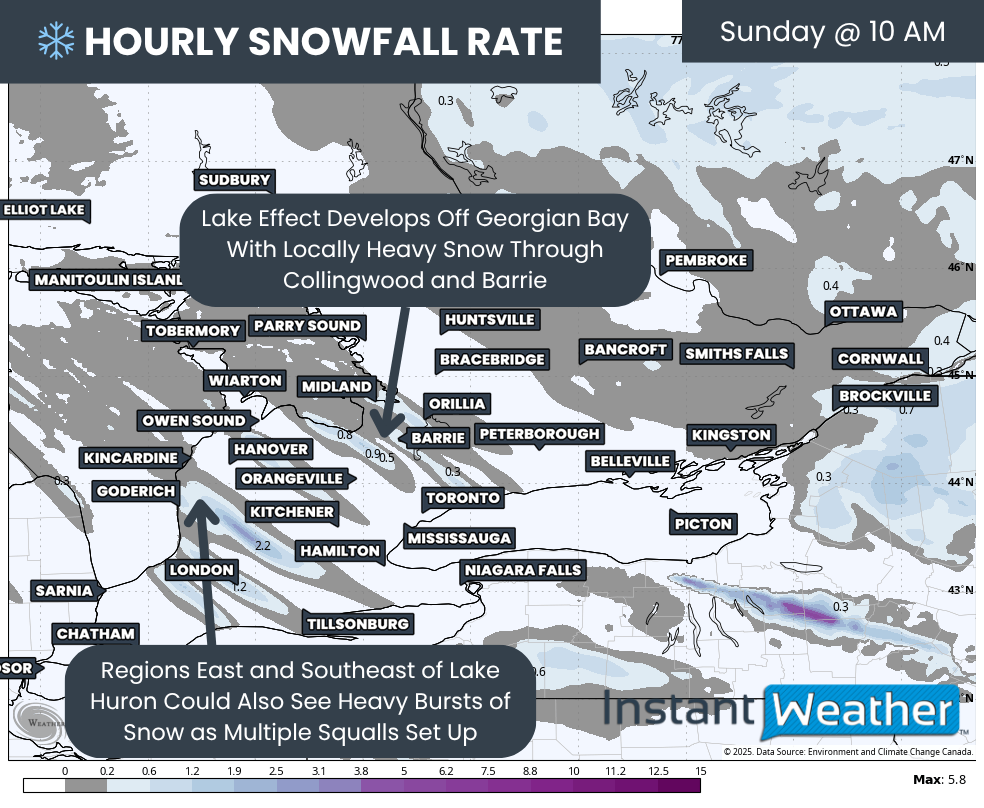
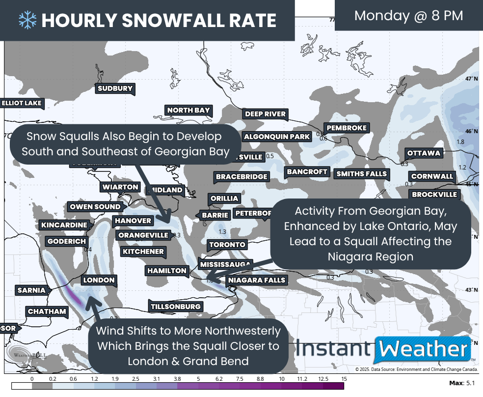
For the rest of Southern Ontario, less than 5 cm is expected by the end of Saturday. However, regions like Barrie, Kitchener-Waterloo, and London could see some snowfall accumulation on Sunday and Monday as the winds shift late Saturday. So, if you’re hoping for snow in those areas, don’t give up yet!

Stay tuned for more updates, including our next detailed forecast on Saturday!

Season’s First Snowfall Possible for Wide Swath of Southern Ontario Starting Late Wednesday

NOTE: YOU CAN CLICK ON THE MAP TO OPEN A ZOOMABLE IMAGE

Over the past week, calm conditions have dominated the weather story across Southern Ontario. This pattern has also brought a return to more seasonal temperatures typical for this time of year, a noticeable shift from the unseasonably warm weather that lingered into early November.


GOOGLE AD (NOT ENDORSED BY INSTANT WEATHER)

One notable absence so far this season is snow—a staple of November in Southern Ontario. While some regions, especially higher elevations in Central Ontario, the Ottawa Valley, and the Dundalk Highlands, experienced their first flurries as early as September and October, much of Southern Ontario has yet to see its first snowfall.

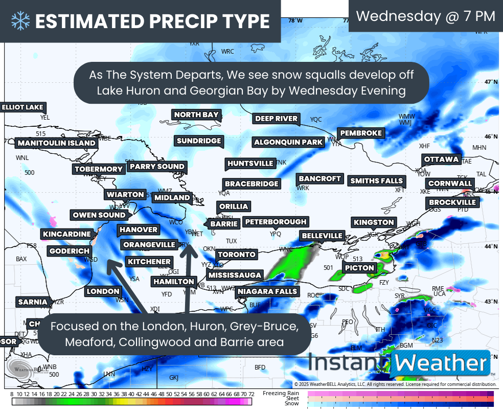
That, however, could soon change with the arrival of multiple weather systems in the coming days, bringing colder air and the potential for wet flurries as early as Wednesday evening and into Thursday and Friday.

The good news for those not yet ready to embrace winter is that significant accumulation isn’t expected with this initial blast of wintry weather. Temperatures are forecast to hover just above freezing, which will likely limit accumulation as any snow melts upon contact with the wet and relatively warm ground left behind by earlier rainfall.


GOOGLE AD (NOT ENDORSED BY INSTANT WEATHER)

In addition to the season’s first flurries, a slow-moving system will stall over the Great Lakes region, pulling in moisture from another system over New England. This setup will lead to ample precipitation, with heavy rain expected to persist into the start of the weekend. Eastern Ontario is poised to bear the brunt of this rainfall, with totals ranging from 25 to 50 mm between Wednesday and Saturday.

SIMULATED RADAR - MAP FROM WEATHERBELL

The rain is expected to begin on Wednesday afternoon, with the initial band of heavy rain arriving in Deep Southwestern Ontario and areas near the Lake Erie shoreline by dinnertime.

This line of precipitation may also bring embedded, non-severe thunderstorms and wind gusts of 70-80 km/h. While most gusts are expected to remain below the severe threshold, isolated gusts near 90 km/h are possible, particularly over the Niagara region during the early evening hours.


GOOGLE AD (NOT ENDORSED BY INSTANT WEATHER)

PRECIPITATION TYPE - MAP FROM WEATHERBELL

As this line of rain races across Southwestern Ontario and into the Golden Horseshoe, colder air will begin rushing in from the west. However, there is some disagreement among models regarding how quickly temperatures will drop and how rapidly the precipitation will move. Some projections suggest a sharp cooldown, with temperatures in Southwestern Ontario nearing freezing by Wednesday evening.

If this happens, rain could transition to wet snow in areas such as Sarnia, London, Goderich, Kitchener, Guelph, and Orangeville. However, with earlier rainfall and temperatures still above freezing, any snow is likely to melt on contact. Elevated areas northwest of the GTA, particularly the Dundalk Highlands, may see light accumulation of up to 2-4 cm overnight into Thursday morning.


GOOGLE AD (NOT ENDORSED BY INSTANT WEATHER)

PRECIPITATION TYPE - MAP FROM WEATHERBELL

By Thursday morning, most of the moisture will shift into Central and Eastern Ontario, with the centre of the low-pressure system stalled over Lake Huron. Meanwhile, a secondary system over New England will provide additional moisture, enhancing precipitation over Eastern Ontario throughout the day.

Temperatures in parts of Eastern Ontario, particularly southwest of Ottawa and in higher elevations, will hover near the freezing mark, creating a chance for wet flurries. Closer to the international border extending into the Ottawa region, heavy rain will likely continue.

Precipitation is expected to persist overnight Thursday and linger into Friday, with the heaviest rain focused on Eastern Ontario. In Central and Southwestern Ontario, lingering showers are possible Friday morning and afternoon, though they won’t be as intense as in the east.


GOOGLE AD (NOT ENDORSED BY INSTANT WEATHER)

NOTE: YOU CAN CLICK ON THE MAP TO OPEN A ZOOMABLE IMAGE

For rainfall totals, Eastern Ontario, including Kingston and Ottawa, can expect 25 to 50 mm by Saturday. The rest of Southern Ontario will likely see 10 to 25 mm, though isolated pockets could receive closer to 30-40 mm during thunderstorm activity.

Higher elevations in Eastern Ontario, particularly near Bancroft, may see persistent snow showers that could result in minor accumulation of up to 2-5 cm by Friday morning. However, with temperatures so close to freezing, it’s uncertain how much snow will stick.


GOOGLE AD (NOT ENDORSED BY INSTANT WEATHER)

Looking ahead to the weekend, there’s good news for those not ready for snow. Earlier model predictions suggested a significant cooldown that could trigger lake-effect snow. However, the latest data indicates the cooldown won’t be as intense as initially thought.

While some lake-effect showers are still possible along the Lake Huron shoreline and southeast of Georgian Bay on Saturday, it likely won’t be cold enough for those showers to fall as snow.

What's in a Name? Choosing the Right Tires to Drive you Through Canadian Winters

Tread patterns of summer, all season and winter tires. Image courtesy of discount tire.

Now that it’s the first week of November, many Canadians are starting to think about putting winter tires on their vehicles. There have been pockets of unseasonable warmth across the country in October and the start of November, the inevitable chill of winter is in the air, and many have already seen snow fall.

While winter tires are recommended throughout the country, they are mandatory in Quebec from December 1st to March 15th, and from October 1st to April 30th on certain British Columbia highways. Additionally, studded tires are allowed almost nationwide, with the exception of residents of Southern Ontario.

Insurance companies across the country offer discounts for installing winter tires as an incentive to encourage drivers to reduce the risk of accidents. So what makes winter tires that much better in the cold and snow than summer tires and where do all season and all weather tires fit into the mix?


GOOGLE AD (NOT ENDORSED BY INSTANT WEATHER)

With the right tools, it can be pretty easy to change your own tires!

Summer Tires

Summer tires are designed to handle both wet and dry road conditions with their wide tread and soft rubber. These tires also usually have deeper grooves that improve traction on wet roads and reduce hydroplaning, making them ideal for the wet spring and summer months.

Winter Tires

Like their name suggests, winter tires have been designed for winter roads. They are made with rubber that stays flexible at temperatures below 7°C (45°F), the magic number at which other tires become stiff and lose traction, greatly reducing their performance. Furthermore, winter tires have different tread patterns that are meant to divert water and slush to the sides, as well as little slits called sipes that increase the overall grip of the tires and helping them maintain contact with icy road surfaces. Over the past several years, tire manufacturers have started to include additional small particles, like crushed glass or walnut shells, that act as little studs on the surface of the tire for extra grip.


Performance of All Season Tires vs Winter Tires with decreasing temperatures. Image courtesy of Discount Tire.

All Season & All Weather Tires

Some people argue that winter tires aren’t necessary if they have all season tires on their vehicle. Unfortunately, this is a slight misnomer because while these tires can handle a bit of cold and snow, they fail to handle heavier snowfalls that are common in Canadian winters. All season tires, unfortunately, sacrifice traction in wet conditions that would be found in summer tires and some of the flexibility and grip seen with winter tires in order for the tread to last longer. Realistically, these should be called 3 season tires as opposed to all season. So while they’re not the best option for winter driving in Canada, all season tires are definitely a better choice than regular summer tires.

All weather tires, not to be confused with all season tires, are a true year-round tire designed to handle Canadian winters. Unlike all season tires, these tires remain soft and flexible well below 7°C. The tread pattern on all weather tires is a combination of all season and winter tires, making them better suited for driving through heavier snow than all season tires. While they still don’t match the performance of a true winter tire, all weather tires are the best option for those who don’t want the hassle of swapping out their tires twice per year or simply do not have the space to store an extra set. Their versatility truly makes all weather tires a middle of the road tire (pun intended) for Canadian drivers.


The three-peak mountain snowflake symbol found on winter and all weather tires. Image courtesy of Canadian tire.

When looking for tires to get you through the winter, it is recommended to chose either a proper winter tire or an all weather tire, so long as it has the three-peak mountain and snowflake symbol on the sidewall. This is an industry standard symbol which indicates that the tire meets strict regulations for winter performance; becoming mandatory on all winter tires beginning in 2018, transitioning away from just using the M+S (Mud and Snow) designation.


Further Reading

https://www.canadiantire.ca/en/how-to/automotive/how-to-choose-winter-tires.html

https://www.continental-tires.com/ca/en/tire-knowledge/winter-tire-laws-in-canada/

https://www.continental-tires.com/ca/en/tire-knowledge/winter-tire-markings/

https://www.discounttire.com/learn/tires-below-45

https://www.discounttire.com/learn/winter-summer-allseason

Note: The author formerly received payments from “Big Tire” however, this article was not funded.
Spooky Snow May Make an Appearance in Parts of Ontario to Kick Off Halloween Week

NOTE: YOU CAN CLICK ON THE MAP TO OPEN A ZOOMABLE IMAGE

The month of October has mostly brought calm and mild conditions to Ontario, with temperatures occasionally climbing above seasonal averages and minimal precipitation. But as we approach the final days leading up to Halloween, colder air is making a return, setting the stage for a possible wintry “trick” in parts of the region.


GOOGLE AD (NOT ENDORSED BY INSTANT WEATHER)

This past week, temperatures in some areas reached the upper teens and even low 20s, but now a noticeable chill has settled in. Many spots across Southern and Northern Ontario are already experiencing single-digit highs as the warm air retreats.

As the weekend progresses, the cold will only deepen, with Sunday morning expected to bring temperatures near or just below freezing across the province. Afternoon highs will provide little relief, as most places in Central and Eastern Ontario will likely struggle to rise out of the single digits.


GOOGLE AD (NOT ENDORSED BY INSTANT WEATHER)

A Weak Weather System and a Chance of Snow

PRECIPITATION TYPE FOR SUNDAY EVENING - MAP FROM WEATHERBELL

On Sunday, a weak weather system will begin to make its way into Northeastern Ontario and eventually move toward Central Ontario by the afternoon. This will likely bring some light rain showers to areas like Sault Ste. Marie, Sudbury, North Bay, and Muskoka. As colder air continues to push southward after sunset, temperatures will drop quickly, setting the stage for a possible transition from rain to wet snow in the evening.


While surface temperatures are expected to stay just above freezing until after midnight, colder air moving in aloft may allow the rain to change to snow as the night progresses. Precipitation will gradually spread southeastward, reaching Bancroft, Kingston, and possibly the Ottawa area.

There is some uncertainty about whether Ottawa itself will see any snowflakes, as models suggest that a dry air pocket may limit snowfall, keeping the bulk of moisture just to the south.


GOOGLE AD (NOT ENDORSED BY INSTANT WEATHER)

Potential for Accumulation and a Hard Freeze

ESTIMATED MINIMUM TEMPERATURE ON MONDAY MORNING - MAP FROM WEATHERBELL

Temperatures will continue to drop overnight, leading to what is referred to as a “hard freeze” in areas like Sudbury, North Bay, Algonquin Park, and the Ottawa Valley. During a hard freeze, temperatures remain several degrees below freezing for extended periods, which could kill sensitive plants.

The drop in temperature may also allow for some light snow accumulation, with a dusting of 2-3 cm possible by Monday morning in some areas. Though not a significant amount, it could be enough to create slippery conditions on roads, making for a potentially slow and hazardous Monday morning commute.


Light flurries may linger across parts of Central and Eastern Ontario into late Monday morning, gradually tapering off around noon. With temperatures hovering close to the freezing mark throughout the day, any snow that does manage to accumulate will likely melt slowly. Motorists should remain cautious, as wet or slushy conditions could persist longer than usual.


GOOGLE AD (NOT ENDORSED BY INSTANT WEATHER)

Midweek Warm-Up on the Horizon

ESTIMATED DAYTIME HIGH TEMPERATURE ON WEDNESDAY - MAP FROM WEATHERBELL

For those hoping for a break from the cold, a warm-up is expected by midweek. By Tuesday, daytime highs in parts of Southwestern Ontario could rebound into the low to mid-20s, with the warmer air spreading to Central and Eastern Ontario by Wednesday.

However, the return of milder weather may be accompanied by some wet conditions. A fast-moving weather system is forecast to pass through Southern Ontario on Tuesday, bringing the potential for 15-30 mm of rainfall across Central and Eastern Ontario between late Tuesday and Wednesday.

While the exact track remains uncertain, some models suggest the rain may shift further north, potentially impacting the area differently than initially expected.

GOOGLE AD (NOT ENDORSED BY INSTANT WEATHER)

What’s in Store for Halloween?

ESTIMATED TEMPERATURE FOR HALLOWEEN AT 8 PM - MAP FROM WEATHERBELL


With Halloween fast approaching, many Ontarians are wondering what the weather will be like for Trick-or-Treating. As of now, forecasts indicate a chance of widespread rain across much of Southern Ontario during the afternoon, possibly lingering into the evening. Afternoon temperatures are expected to start in the mid to upper teens, but a cooling trend may bring them down to the low teens or even upper single digits by the time Trick-or-Treaters hit the streets.
There is still some disagreement among models regarding the exact timing of the rain. While it seems the heaviest precipitation may fall earlier in the day, there is a chance that skies could clear in time for the evening festivities, especially in Southwestern Ontario. Meanwhile, Eastern Ontario may be among the last regions to see any potential clearing.

Stay tuned as more details emerge in the days leading up to Halloween, and be prepared for whatever weather “tricks” or “treats” may come your way!

Snowy Surprise: Parts of Ontario & Quebec Could See Season’s First Snowflakes This Weekend

NOTE: YOU CAN CLICK ON THE MAP TO OPEN A ZOOMABLE IMAGE

As we enter the first full weekend of meteorological fall, Mother Nature is set to deliver a taste of autumn across Ontario and Quebec. A brief blast of cold air will cause temperatures to drop near the freezing mark during the pre-dawn hours on Saturday and Sunday.

Precipitation currently affecting Southern Ontario is expected to linger throughout the weekend. The heaviest rainfall totals are expected overnight Friday into early Saturday in Eastern Ontario, with localized amounts of 20-40 mm of rain possible.

The bigger story is when that precipitation wraps around into Western Quebec and Northeastern Ontario later on Saturday, continuing into the early morning hours of Sunday. With temperatures cooling into the low single digits and even colder air aloft, some of that precipitation may fall as wet snow.


GOOGLE AD (NOT ENDORSED BY INSTANT WEATHER)

It appears that locations like Timmins, Cochrane, Kirkland Lake, Temiskaming Shores, Deep River, and Algonquin Park in Ontario could see their first snowflakes of the season. In Quebec, areas such as Ville-Marie, Rouyn-Noranda, Amos, and Val-d'Or may also experience wet snow.

While it's unlikely that snow will accumulate, as it will be mixed with rain and ground surfaces are still too warm, there's a chance that colder-than-expected conditions could lead to a few slushy centimetres in some areas. Any accumulation will melt quickly after sunrise on Sunday as temperatures gradually rise.


NOTE: YOU CAN CLICK ON THE MAP TO OPEN A ZOOMABLE IMAGE

Speaking of Sunday morning, this is when the coldest air of this brief "cold snap" is expected across Ontario and Quebec. Morning lows will likely drop into the single digits across much of Northern and Southern Ontario and Quebec. In Northeastern Ontario and the Algonquin Park region, temperatures could dip to near freezing during the pre-dawn hours, increasing the risk of frost in addition to the potential for wet snow.

Further south, the coldest temperatures in Southern Ontario will be in the higher elevations of Central Ontario, east of Muskoka, where temperatures may plunge to around 2-5°C. It will be moderately warmer in Southwestern Ontario, the Golden Horseshoe, and Eastern Ontario, with morning lows ranging from 5-10°C. Those along the shorelines of Lake Ontario, Lake Erie, Lake Huron, and Georgian Bay will benefit from the warmer lake waters, keeping temperatures above 10°C.

In Quebec, expect low to mid-single-digit temperatures in the western portion of the province near the Ontario border on Sunday morning. Eastern Quebec, including Montréal and Québec City, will see lows in the upper single digits, ranging from 6-12°C.


GOOGLE AD (NOT ENDORSED BY INSTANT WEATHER)

WATERSPOUT RISK FOR GREAT LAKES ON SATURDAY MORNING (SORUCE: ICWR)

This cold air will also contribute to a potential waterspout outbreak over the Great Lakes this weekend. The highest risk is on Saturday, especially in the morning and afternoon, with a focus on Southern Lake Huron and Western Lake Erie. Waterspouts are also possible over Southern Georgian Bay, Western Lake Ontario, and even Lake Simcoe.

While waterspouts rarely threaten land, they can be hazardous for those on the water. In rare cases, waterspouts can come ashore, causing minor damage along the immediate shoreline.

The waterspout risk will persist into Sunday, with a focus on Eastern Lake Ontario.

Looking ahead to next week, warmer weather is expected to return to Ontario and Quebec. By late in the week, temperatures could climb back near the 30°C mark in Southern Ontario. So, while this brief taste of fall may be shocking, it looks like summer isn't quite finished yet.