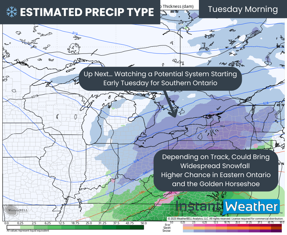
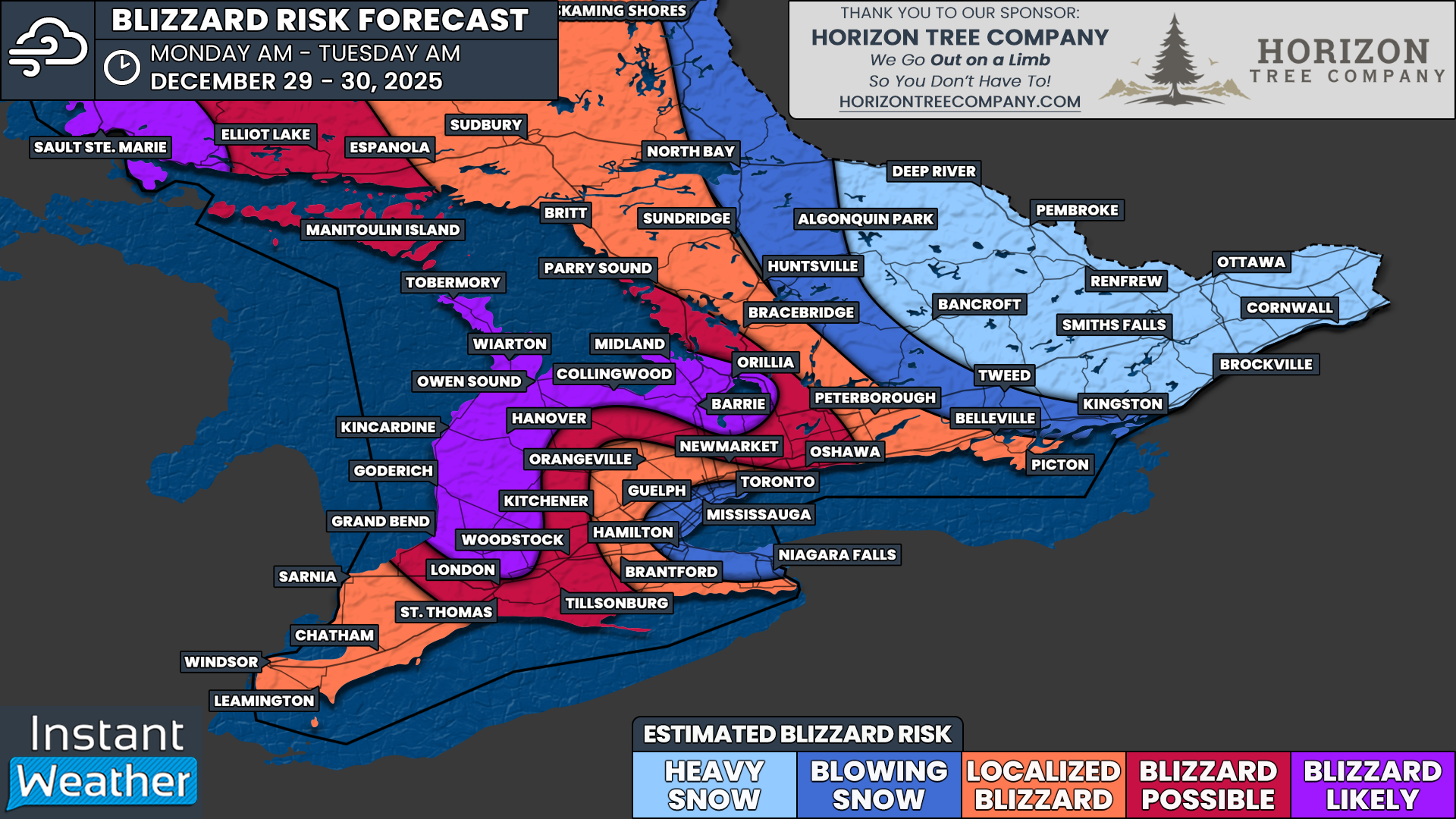
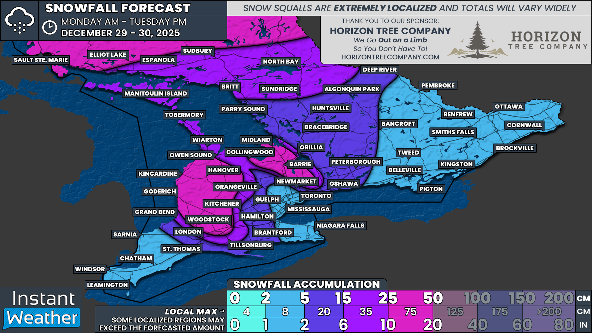
Powerful Wind Storm on Monday to Fuel Blizzard Conditions in Southern Ontario With Up to 25-50 cm of Snow Possible by Tuesday
/
NOTE: YOU CAN CLICK ON THE MAP TO OPEN A ZOOMABLE IMAGE
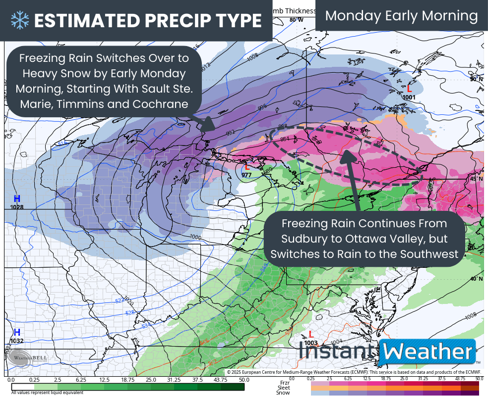
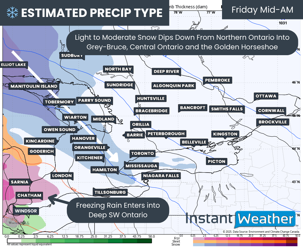
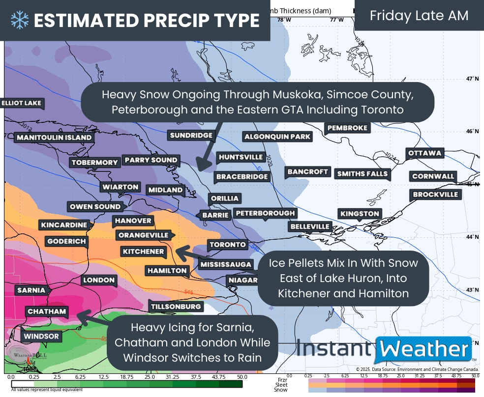
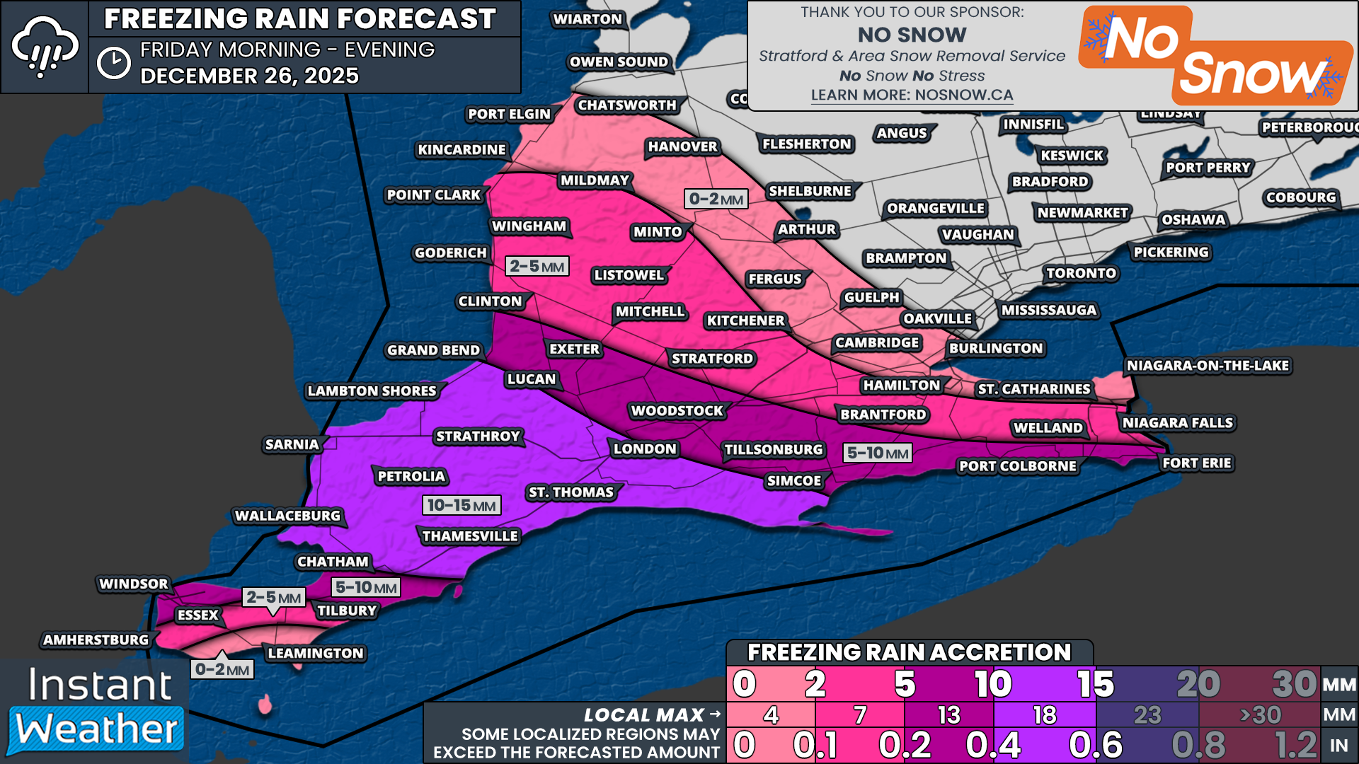
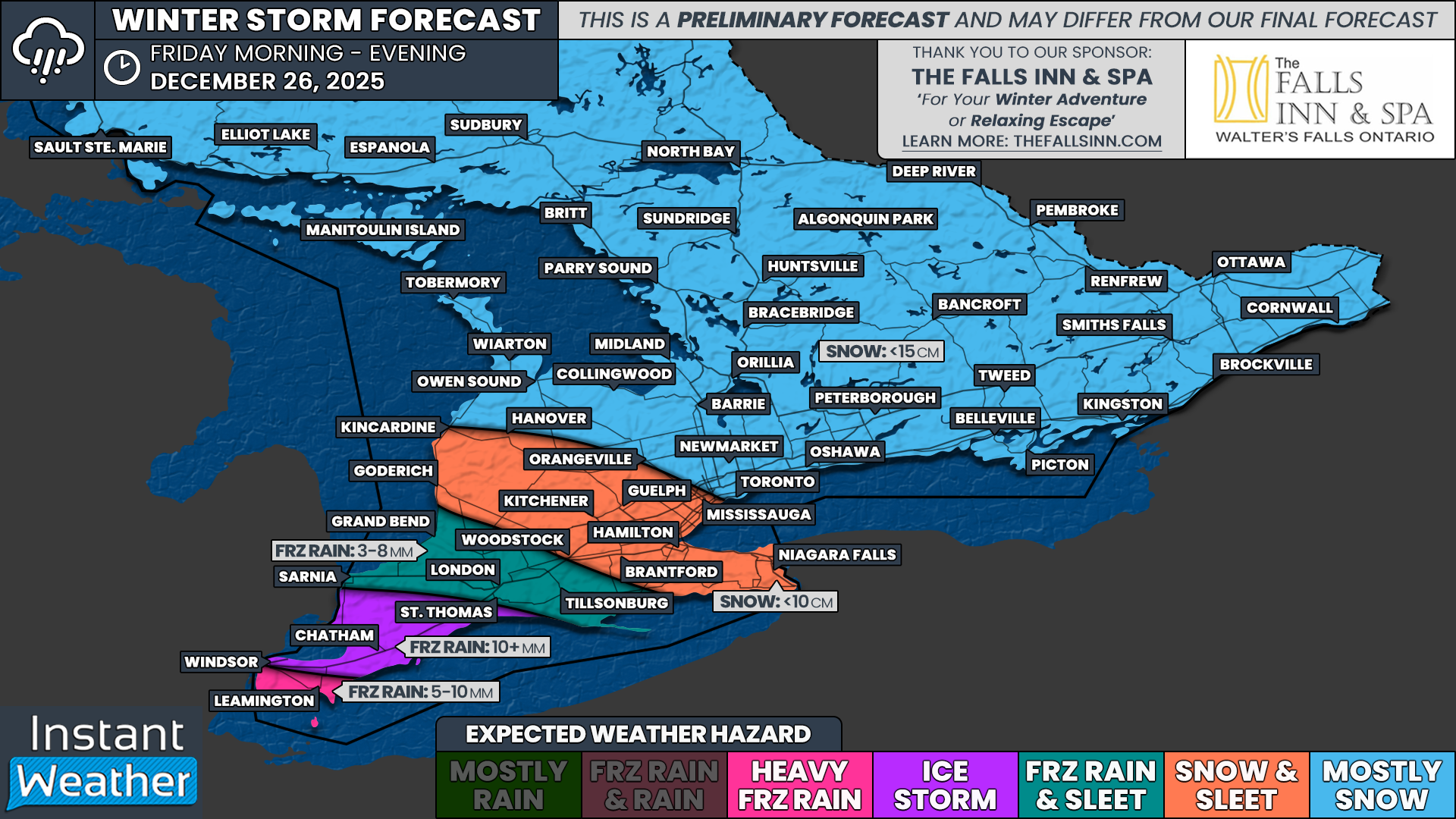
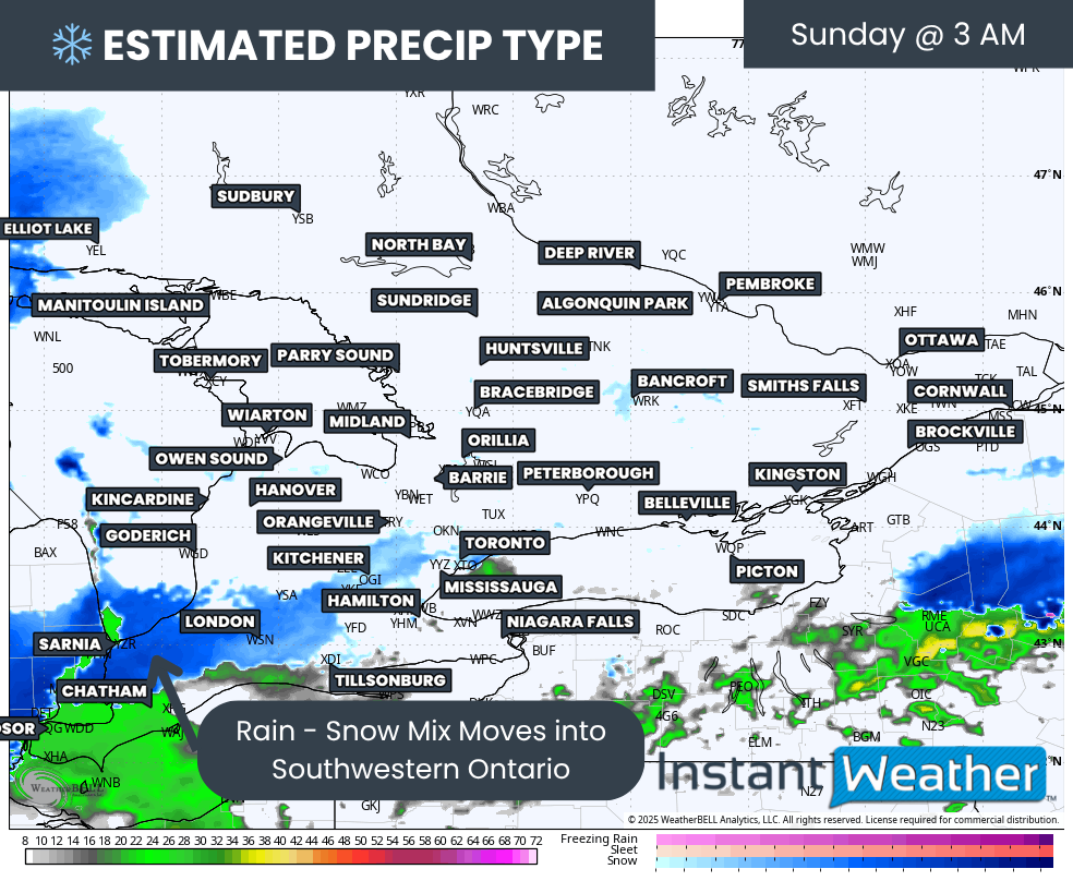
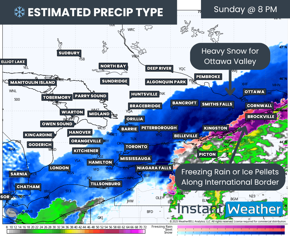
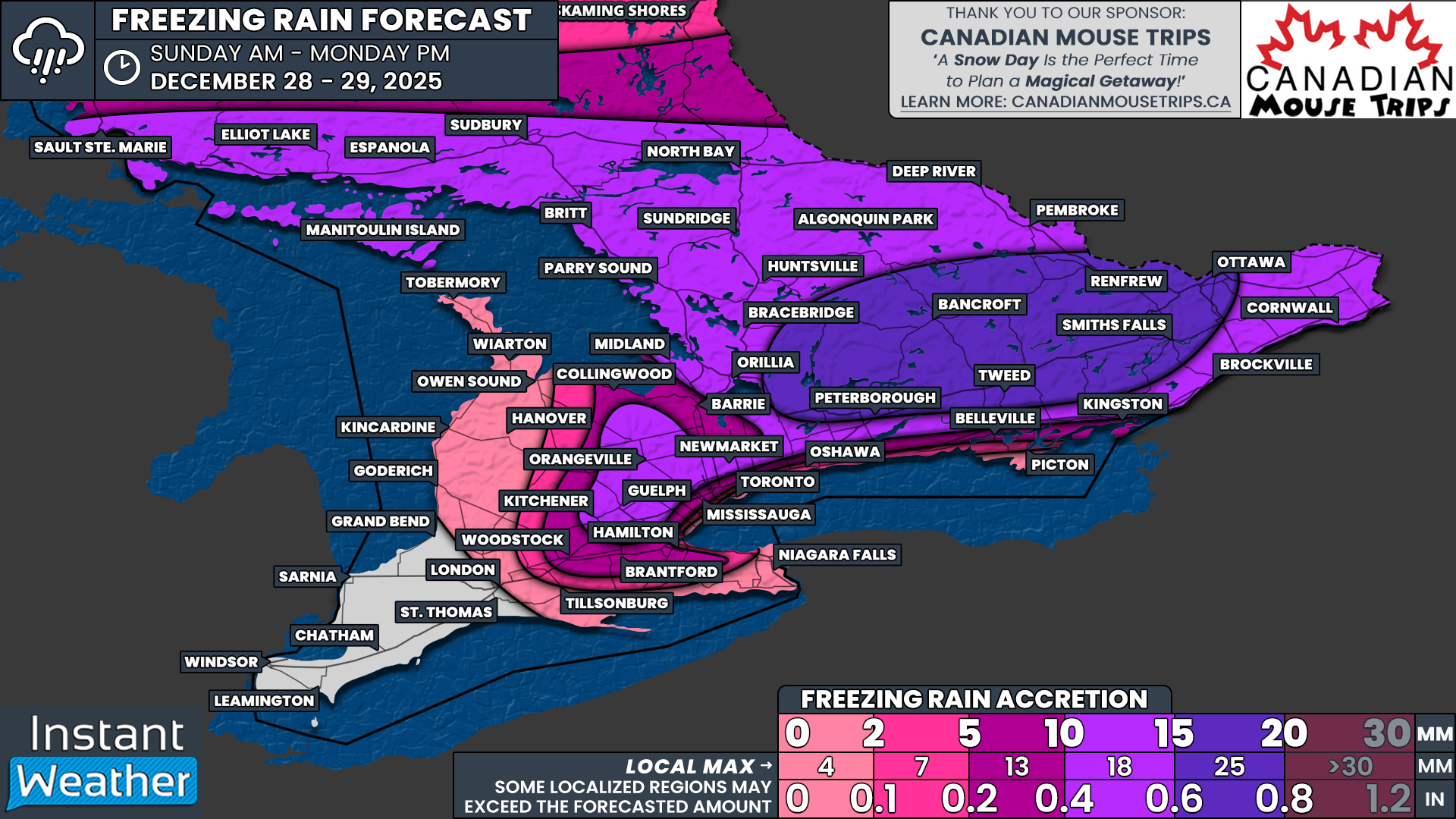
The major winter storm we have been focused on over the past few days has now arrived, bringing hazardous ice storm conditions to parts of Southern Ontario while Northern Ontario continues to deal with heavy snowfall. This system is already creating widespread travel issues and power concerns, and the worst impacts are still unfolding as we head into Monday.
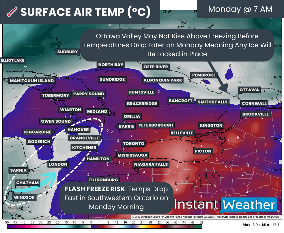
Freezing rain will gradually come to an end by late morning or early afternoon on Monday for most areas as temperatures briefly climb above the freezing mark. While that may offer a short-lived improvement in conditions, it will be followed quickly by another round of dangerous weather as colder Arctic air surges back into the region from the west.
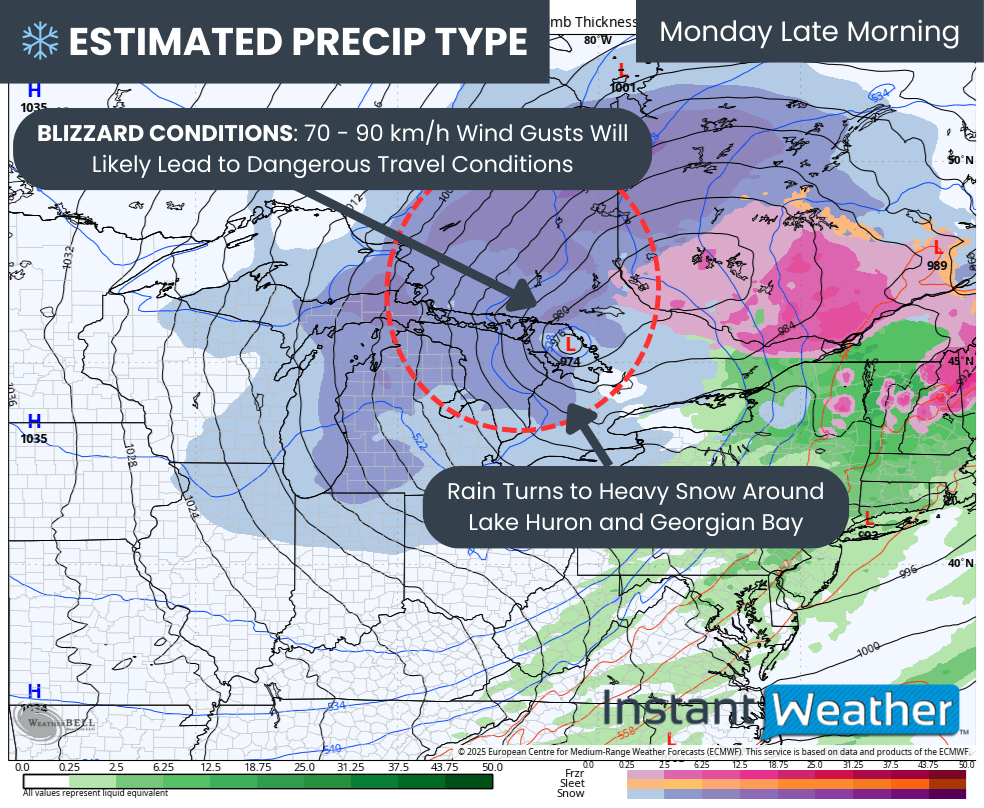
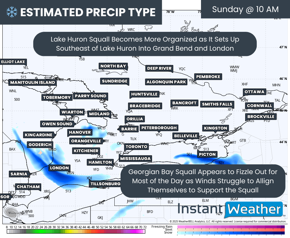
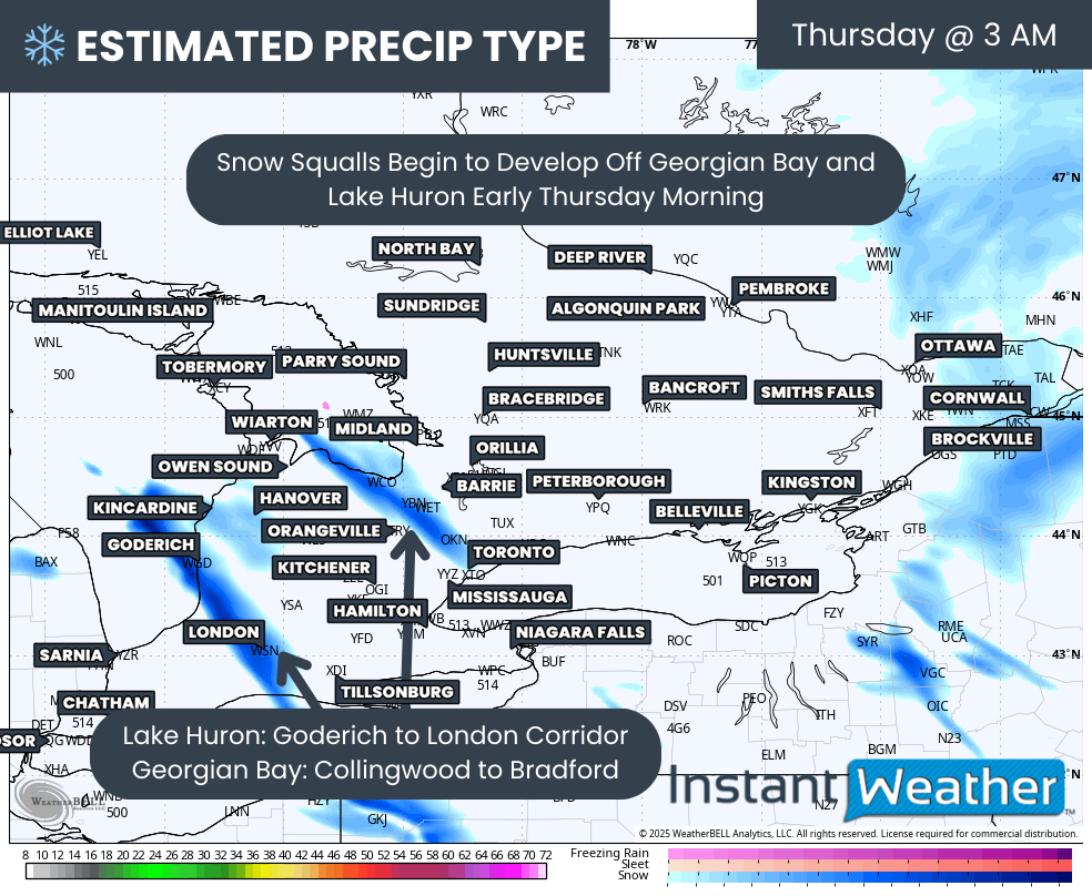
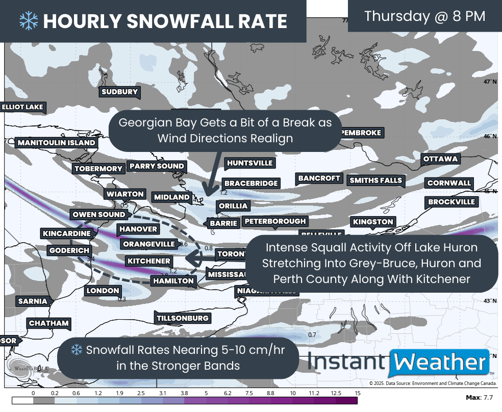
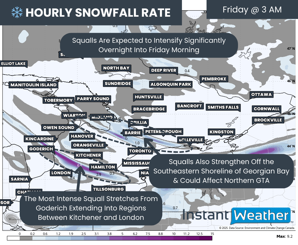
As this colder air pushes in, precipitation will rapidly transition from rain or freezing rain over to snow. This snow will become increasingly enhanced by Lake Huron and Georgian Bay, setting the stage for a prolonged and high-impact snow squall event across much of Southwestern and Central Ontario.
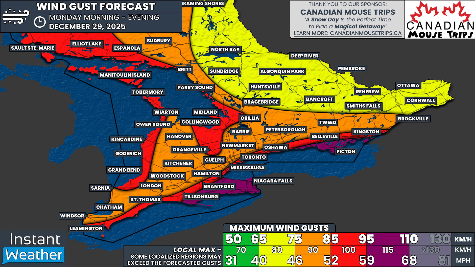
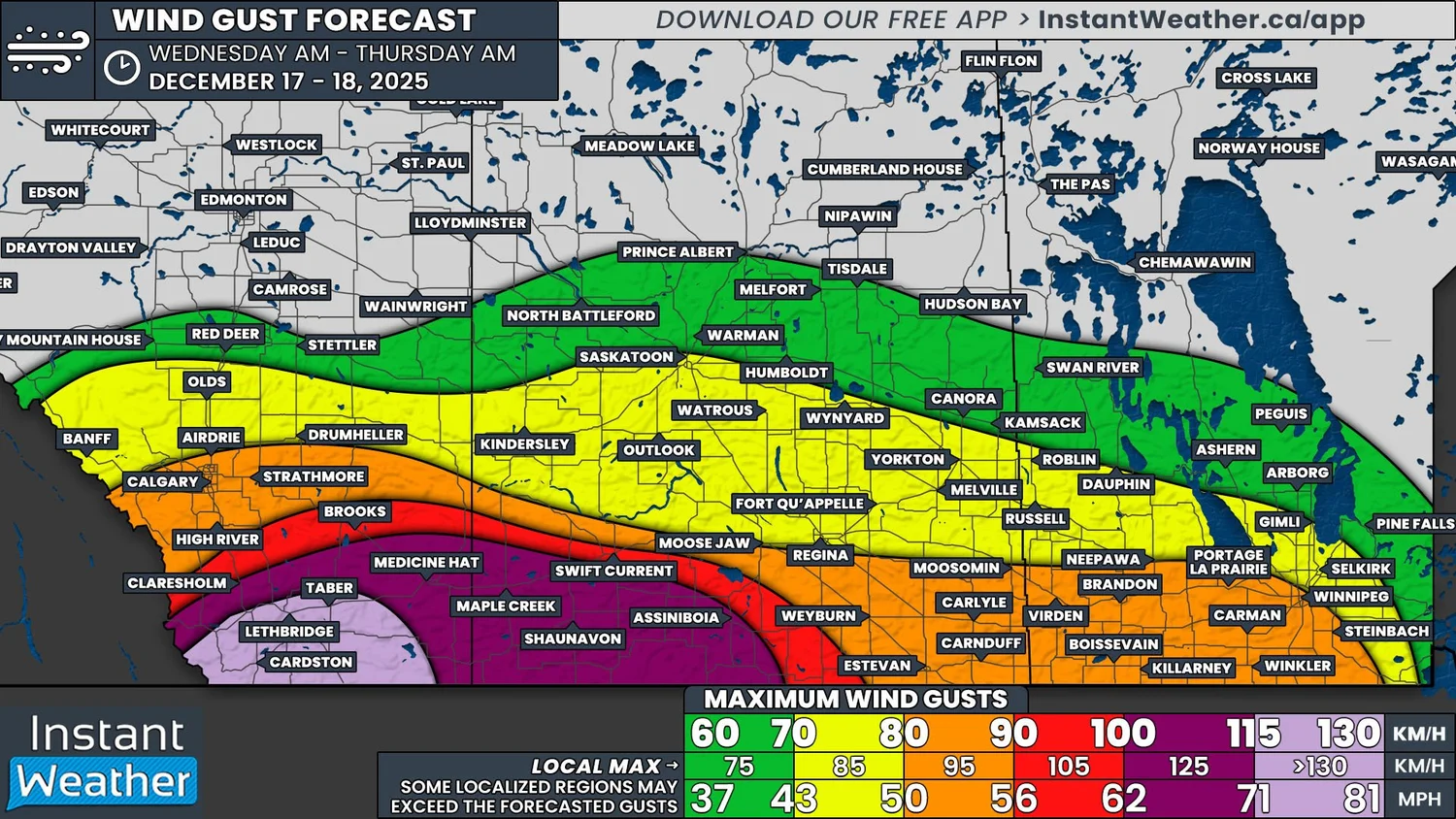
At the same time, a rapidly strengthening low-pressure system will track directly along the lower Great Lakes through early Monday. This setup will drive very strong winds across Southern and Northeastern Ontario, especially near the lakes, with widespread gusts exceeding 90 km/h and locally approaching or exceeding 100 km/h along exposed shorelines.
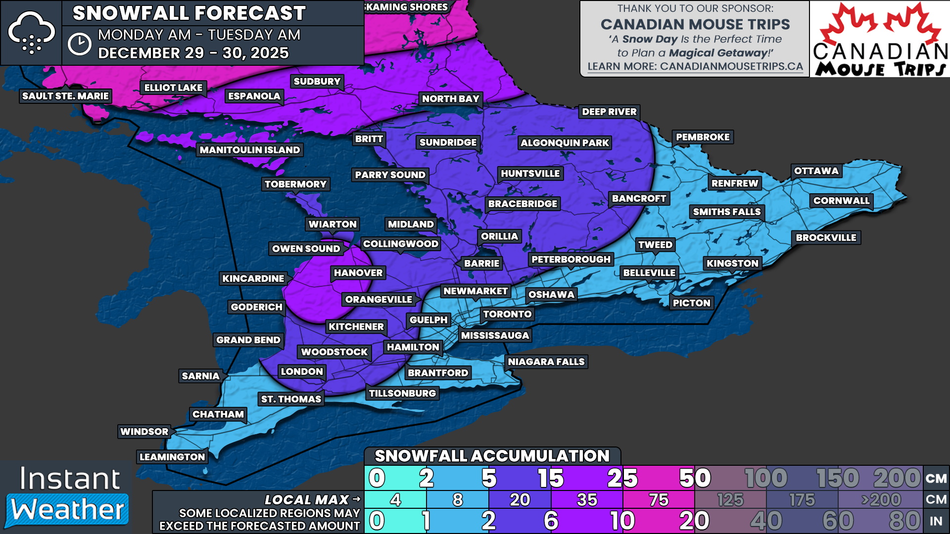
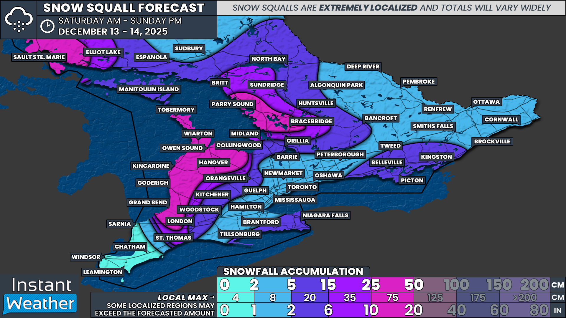
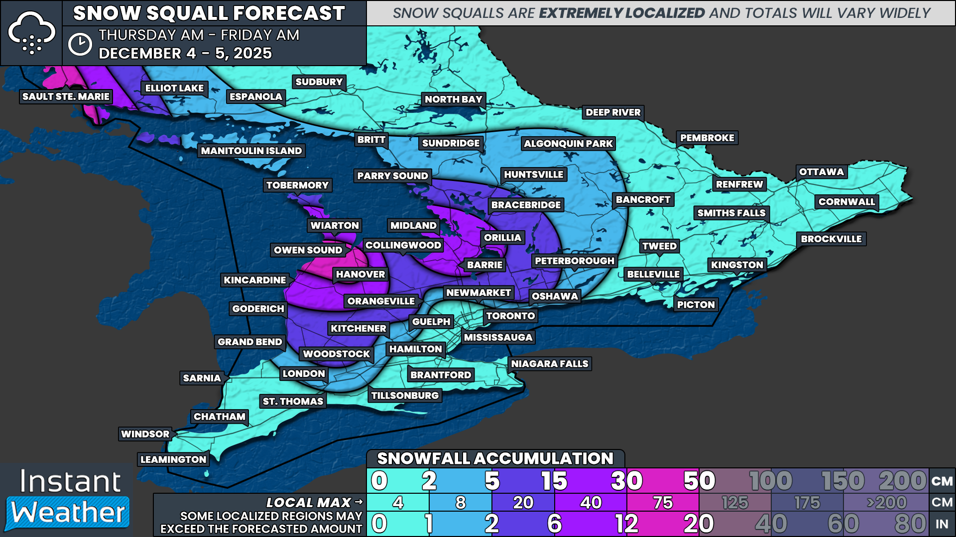
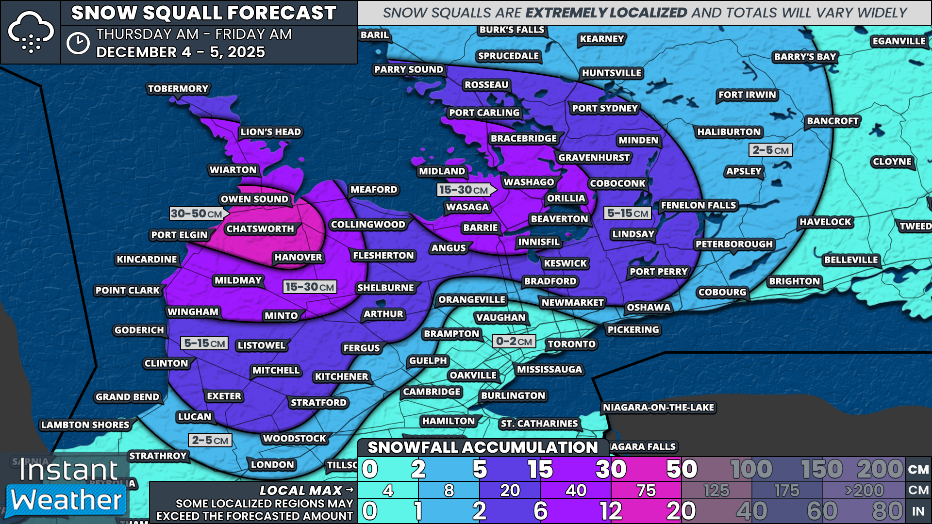
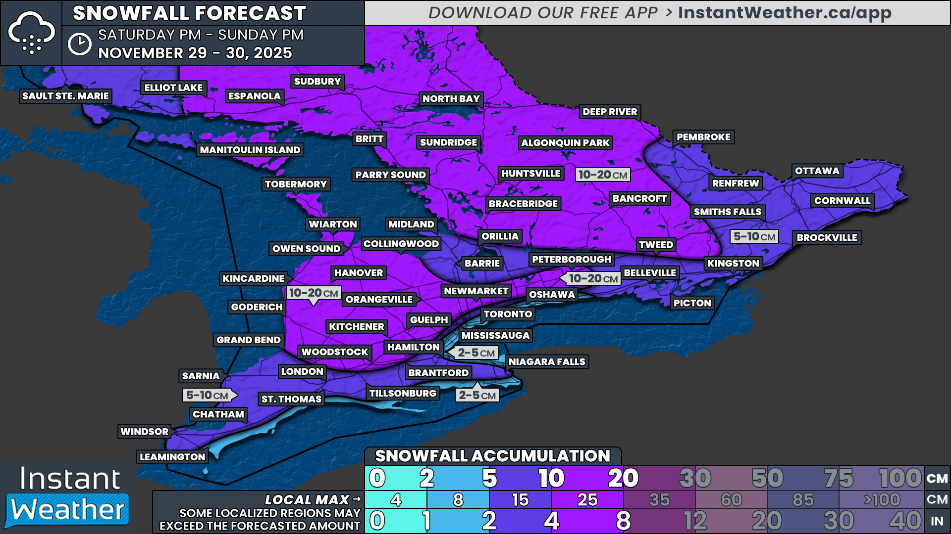
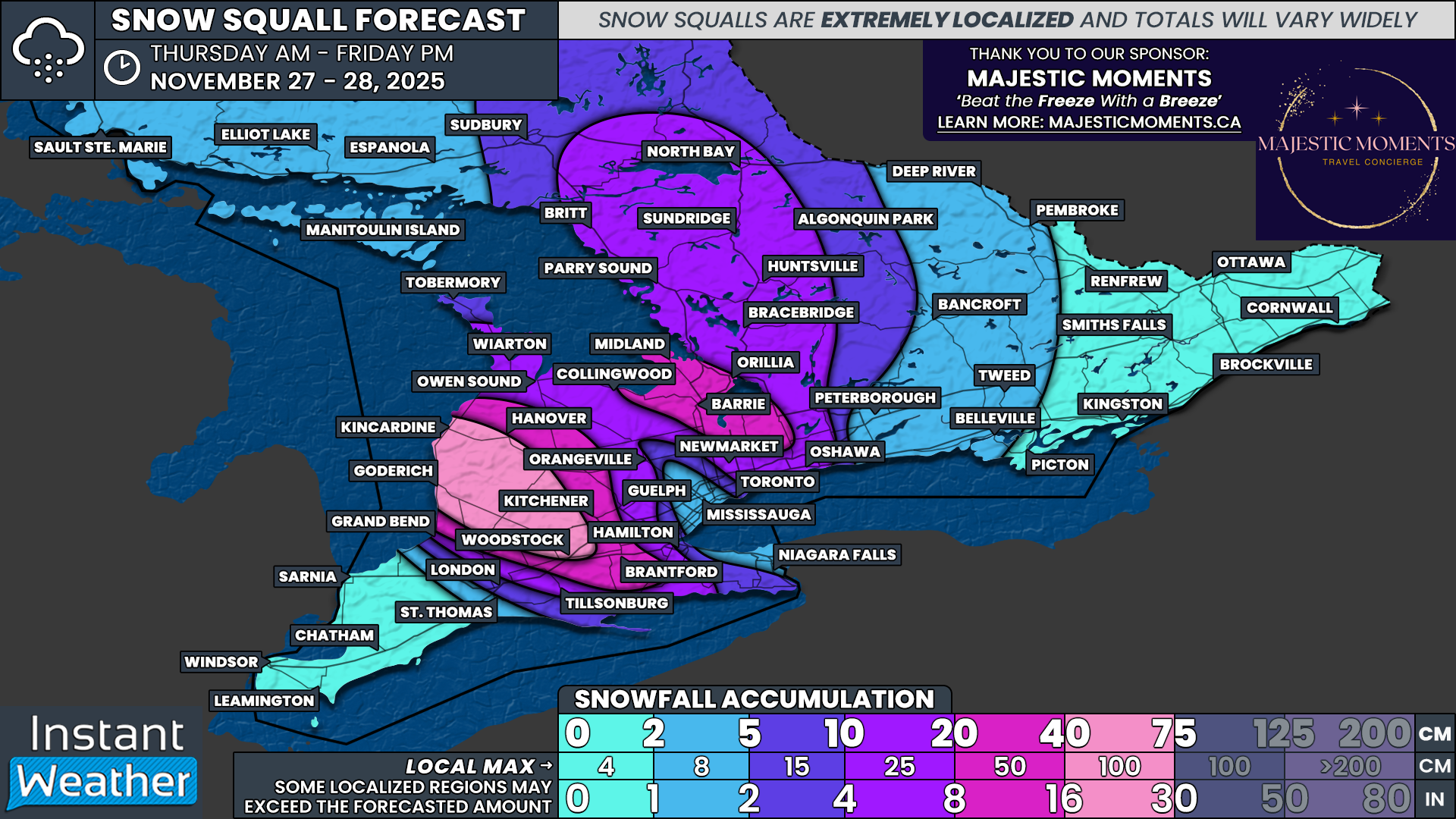
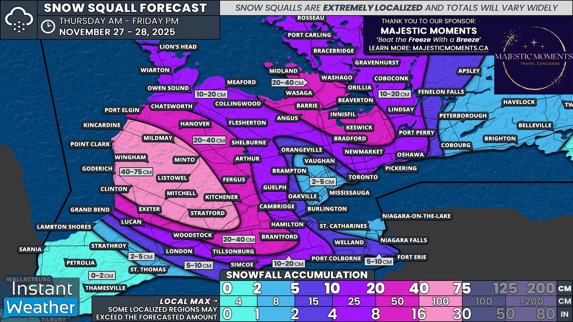
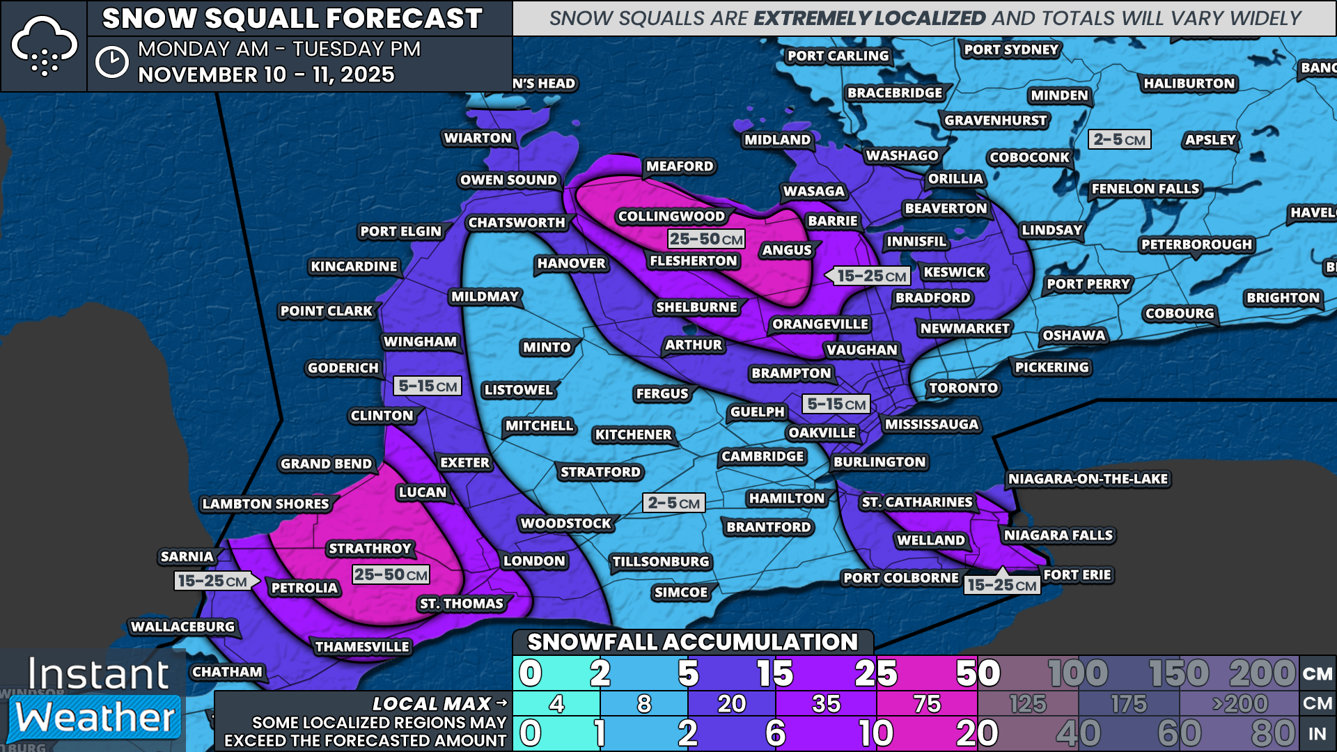
These powerful winds, when combined with heavy snowfall, will lead to blizzard conditions developing east of Lake Huron and southeast of Georgian Bay. Snow squalls will also intensify as the system pulls away, resulting in widespread snowfall totals of 25 to 50 cm across Grey-Bruce, Huron, Perth and Simcoe counties by the end of Tuesday.
The threat of blowing snow and sharply reduced visibility will not be limited to the traditional snowbelt regions. Localized blizzard conditions may extend across much of Southwestern and Central Ontario, including portions of the GTA. Even areas that do not receive significant snowfall could see near-zero visibility at times due to wind gusts in the 70 to 90 km/h range.
Given these conditions, road and highway closures are very likely in the hardest hit areas, especially across the snowbelt. Travel will be extremely hazardous and potentially impossible at times. Non-essential travel should be avoided through Monday and into Tuesday where possible.
Although winds are expected to gradually ease by early Tuesday, snow will continue to pile up east of Lake Huron and southeast of Georgian Bay. With very cold temperatures lingering through the remainder of the week, the snow squall risk could persist in some form for several additional days, depending on wind direction.
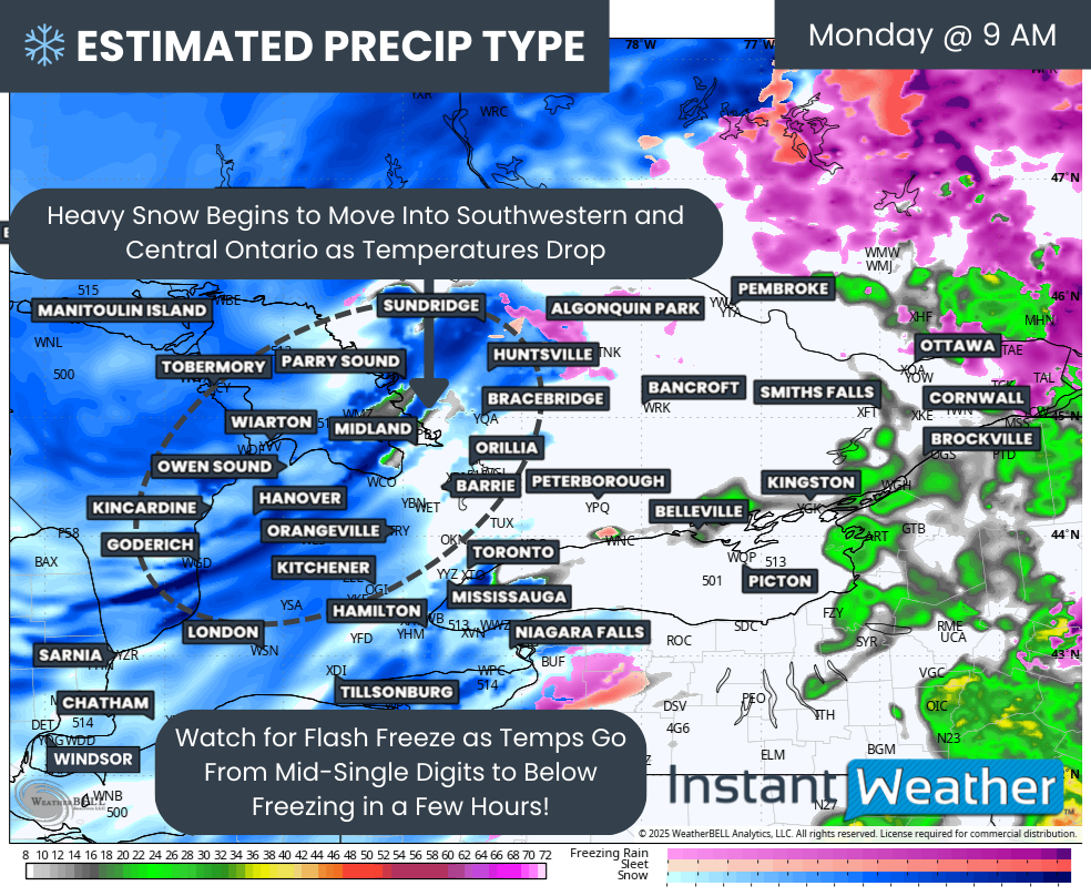
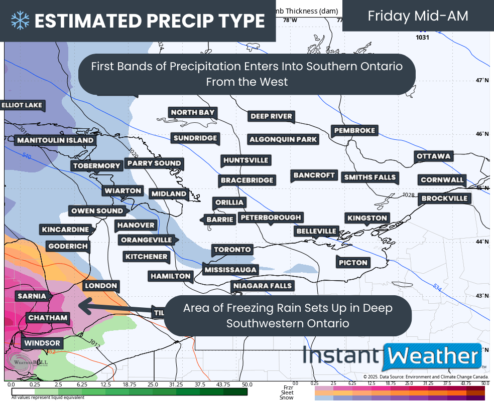
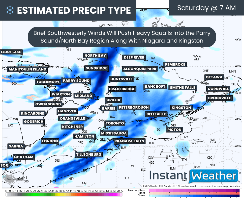
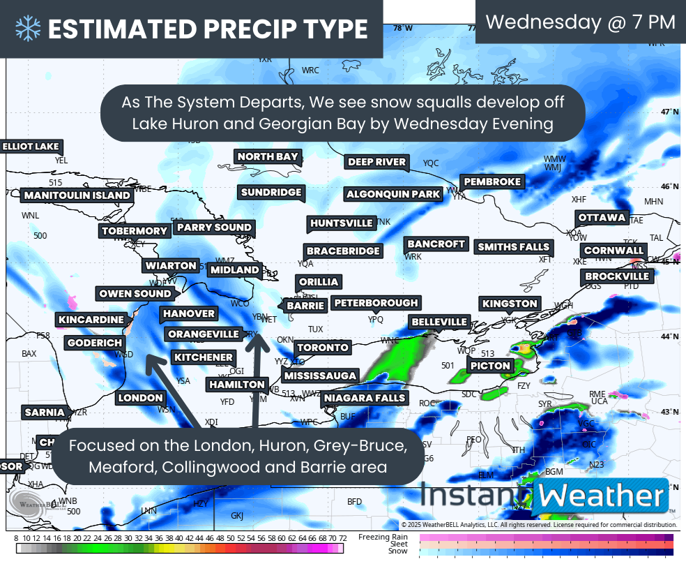
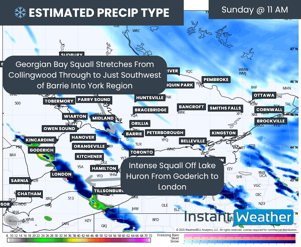
PRECIP TYPE - MAP FROM WEATHERBELL
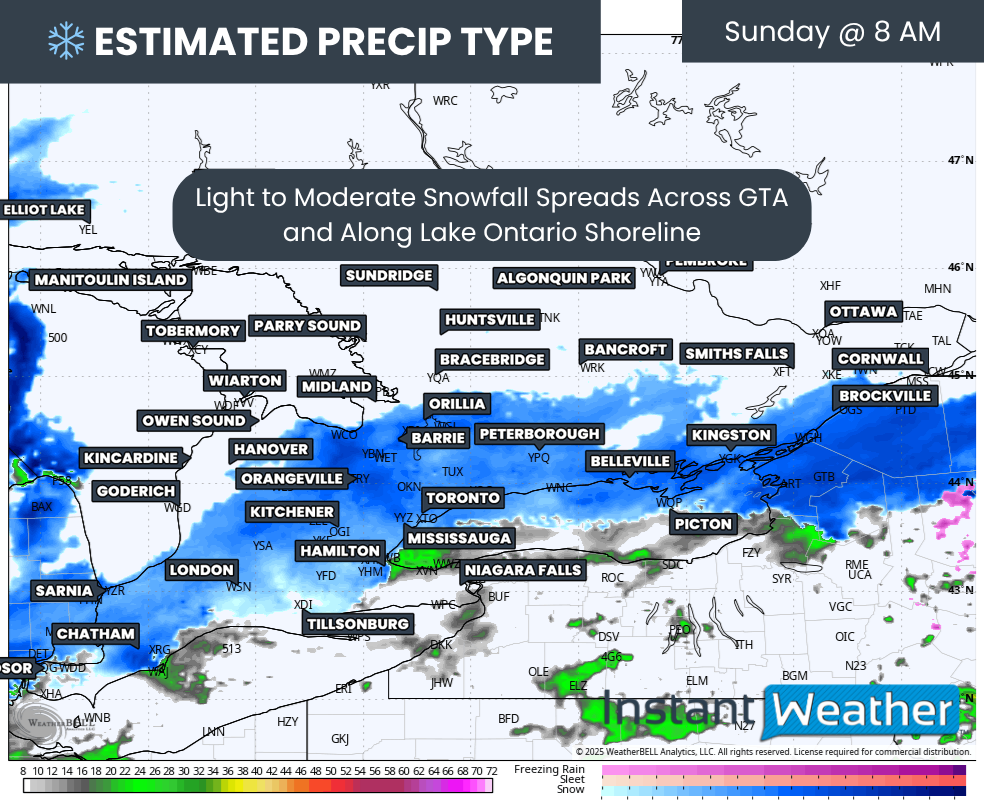
In the Ottawa Valley, freezing rain should come to an end by late morning on Monday as temperatures briefly rise above freezing. Meanwhile, colder air will already be invading areas closer to Lake Huron, with rain changing over to snow as early as mid-morning.
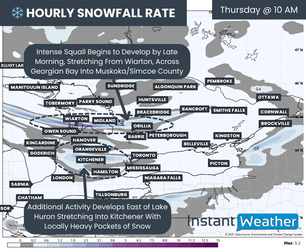
This transition will allow bands of heavy snow to develop through Southern and Central Ontario. There is also the potential for a frontal snow squall to form along the advancing cold front, producing a narrow but intense burst of snow that could rapidly deteriorate travel conditions.
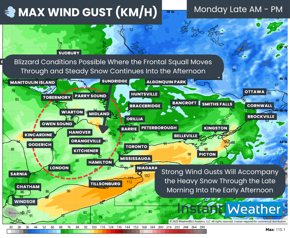
MAX WIND GUST (KM/H) - MAP FROM WEATHERBELL
Adding to the severity of this setup will be the strong winds developing by mid-morning on Monday and continuing through the afternoon. Wind gusts of 90 to 100 km/h are possible near the shores of Lake Huron, Georgian Bay, Lake Ontario and Lake Erie, while areas farther inland could still see gusts reaching 70 to 90 km/h.
When these winds combine with intense snow squalls moving through late Monday morning, blizzard criteria will likely be met in several regions. This is especially true east of Lake Huron, including Huron, Perth, Grey and Bruce counties, as well as areas southeast of Georgian Bay near Lake Simcoe, where winds are expected to be strongest.
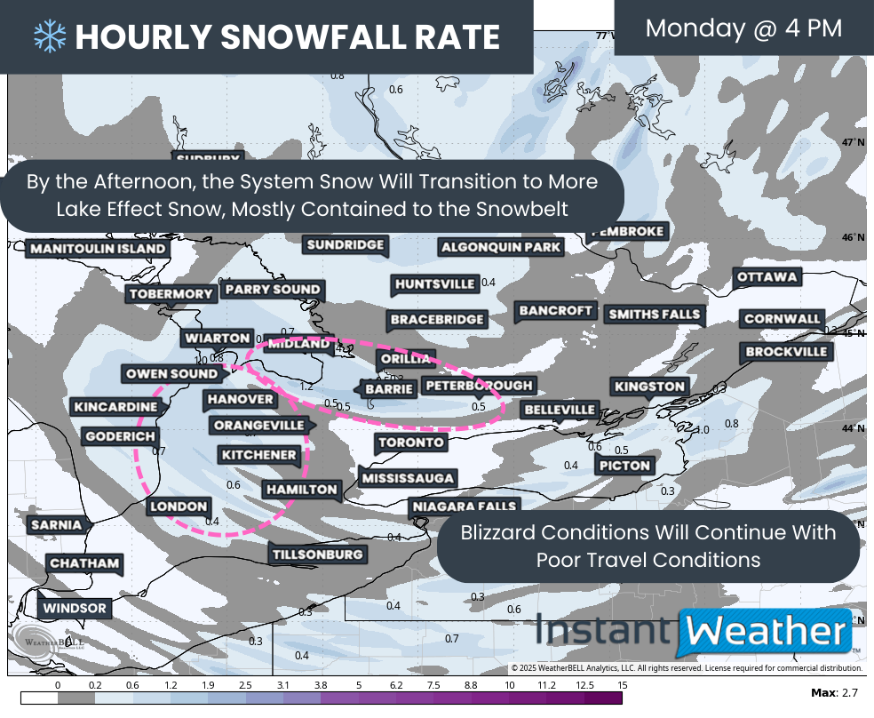
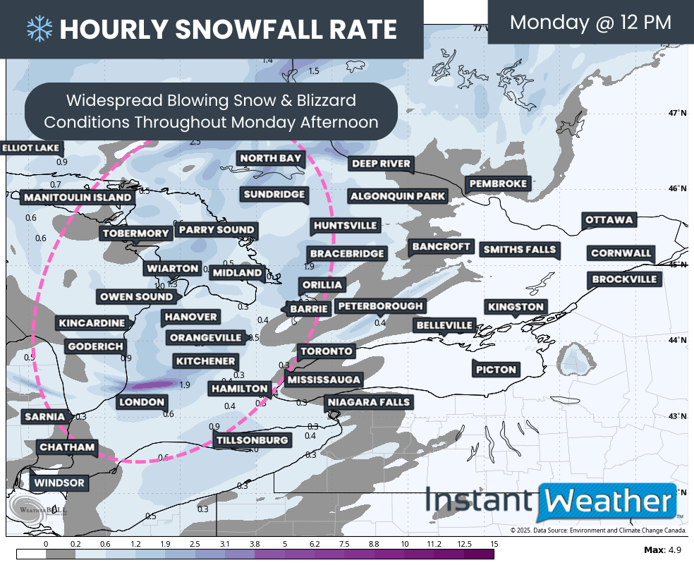
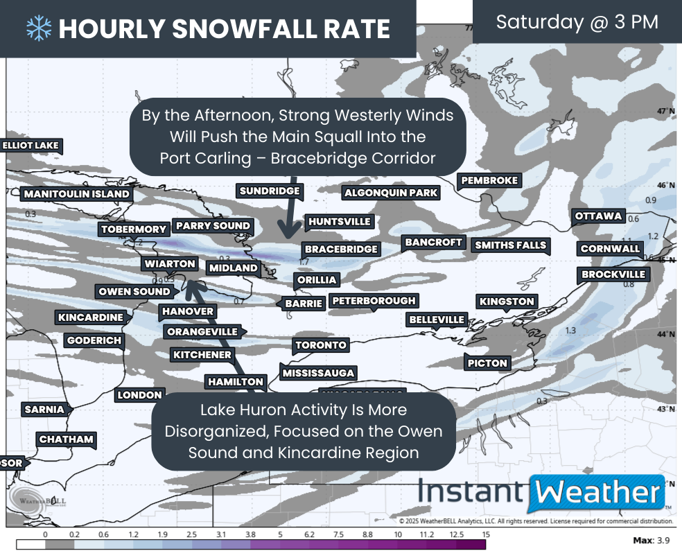
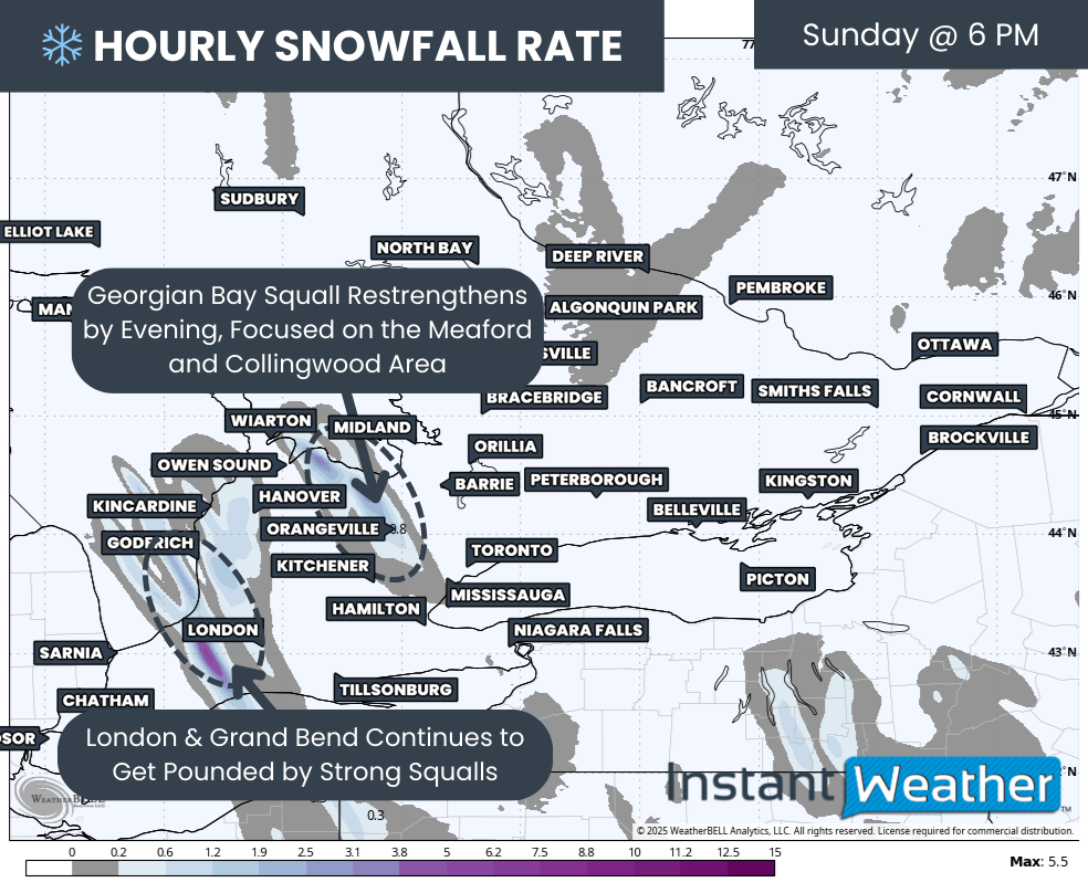
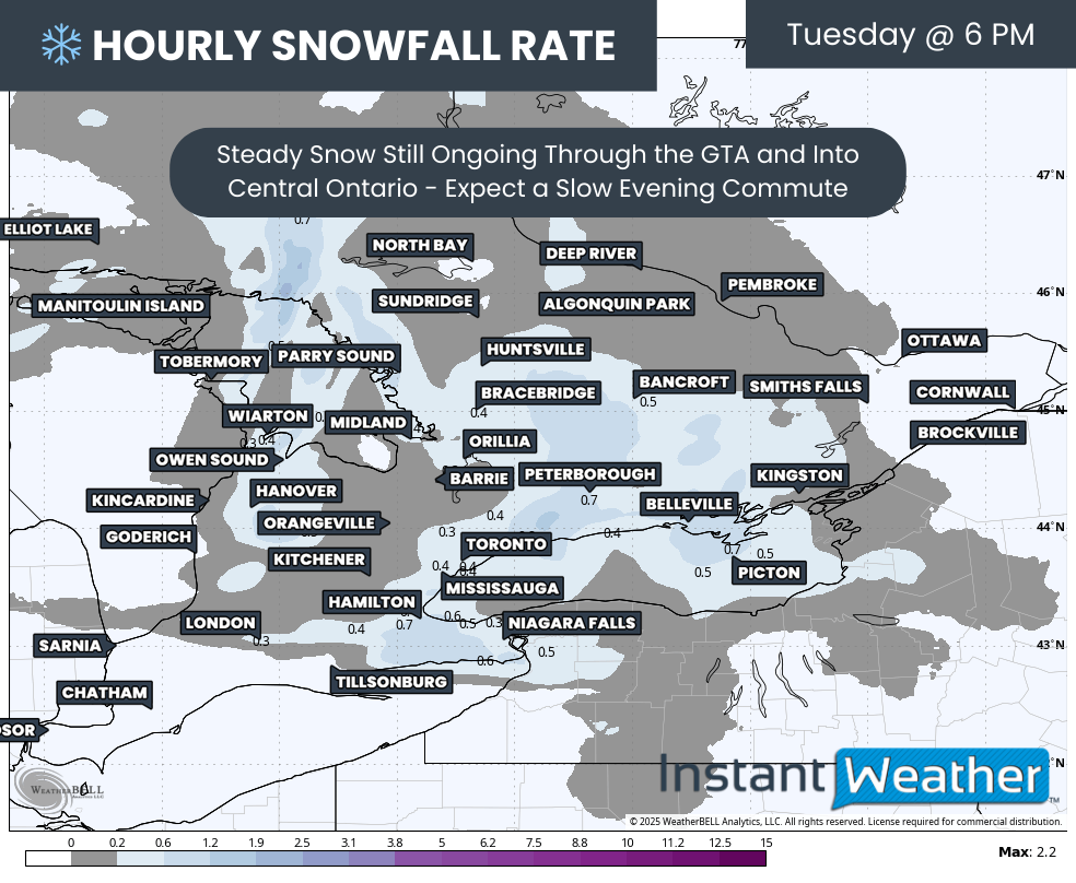
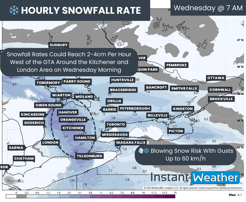
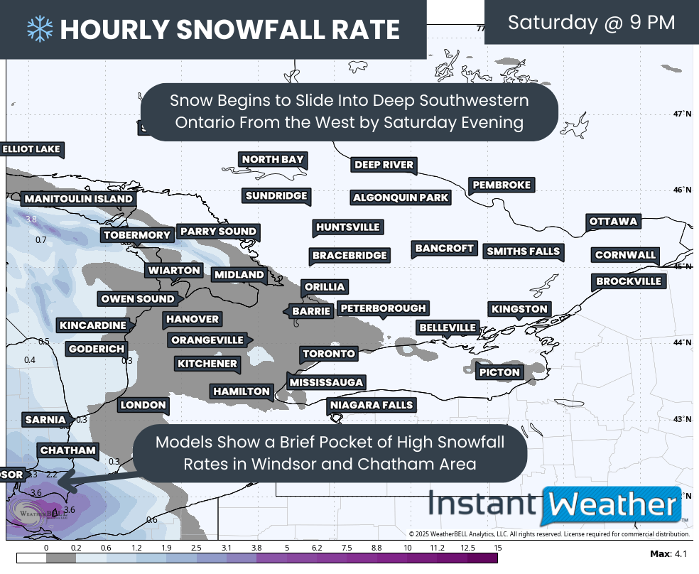
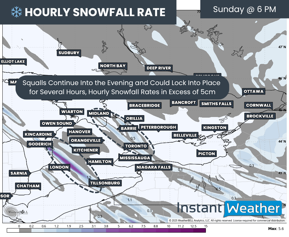
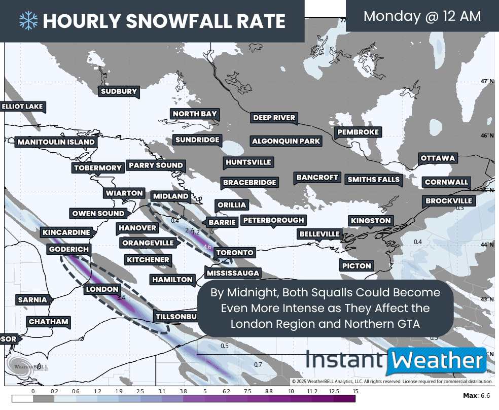
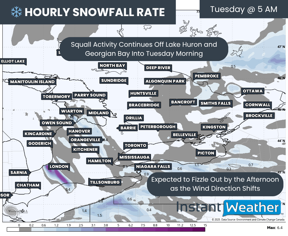
Hourly snowfall rates (cm) - MAP FROM WEATHERBELL
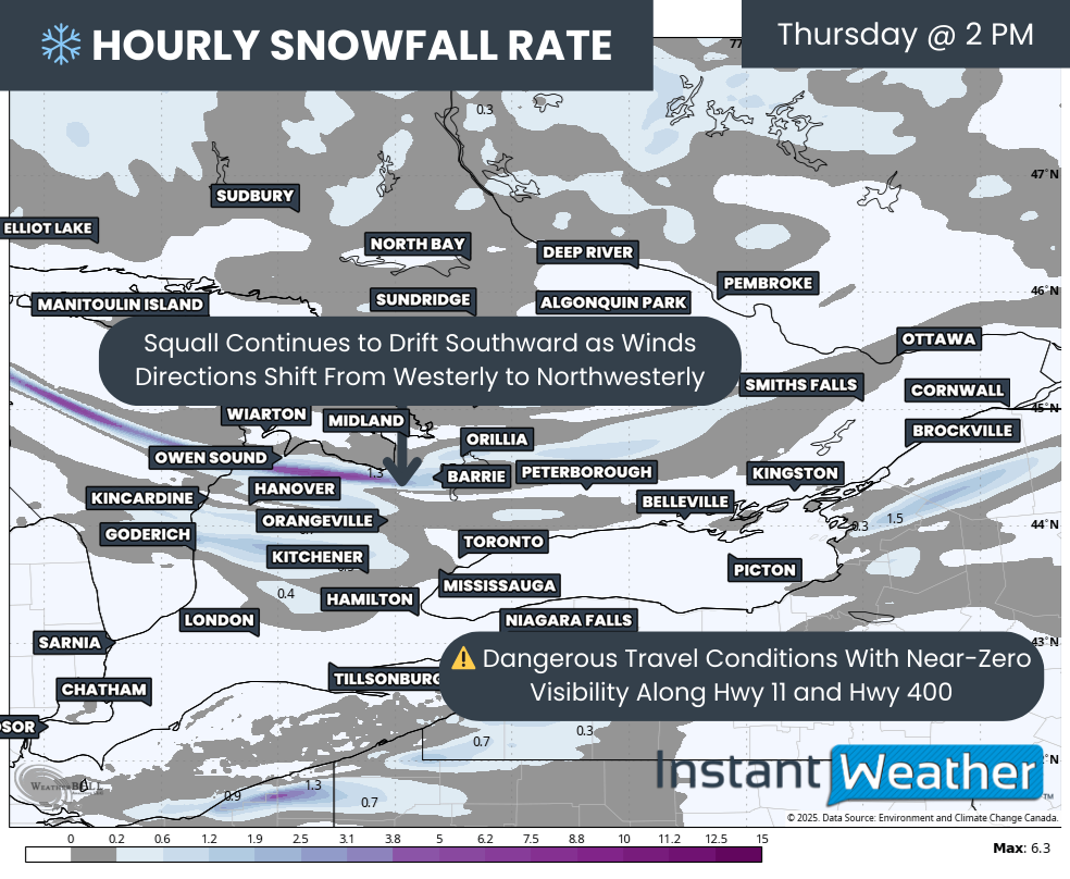
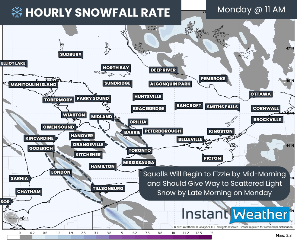
As the main system exits by Monday afternoon, snowfall will become increasingly driven by moisture from the lakes. This will concentrate the heaviest and most persistent snowfall within the snowbelt, particularly east of Lake Huron and around Lake Simcoe, where steady light to moderate lake effect snow will continue.
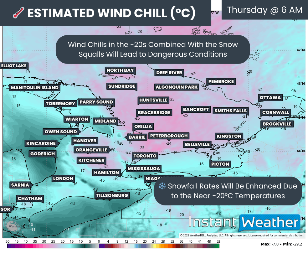
While snowfall rates during this phase may not be extreme, the combination of ongoing snow and strong winds will continue to produce near-zero visibility at times. Blizzard conditions may persist into the evening hours in the hardest hit regions despite somewhat lighter snowfall rates.
Winds will slowly begin to ease overnight into Tuesday morning, but blowing snow will remain a major issue. Gusts of 70 to 80 km/h may still occur east of Lake Huron early Tuesday, keeping travel conditions hazardous even as the most intense blizzard conditions begin to fade.

NOTE: YOU CAN CLICK ON THE MAP TO OPEN A ZOOMABLE IMAGE
The peak period for blizzard conditions is expected from Monday morning through Monday afternoon. During this time, gusts near or above 90 km/h will combine with steady lake effect snow.
Blizzard criteria is most likely to be met around Lake Huron, including areas such as Tobermory, Wiarton, Owen Sound, Kincardine, Hanover, Goderich and Grand Bend, as well as across Simcoe County and parts of northern York and Durham regions.
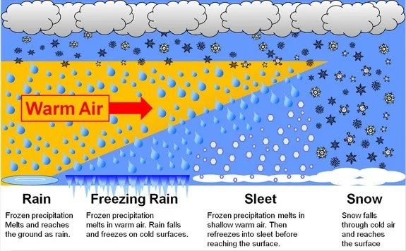
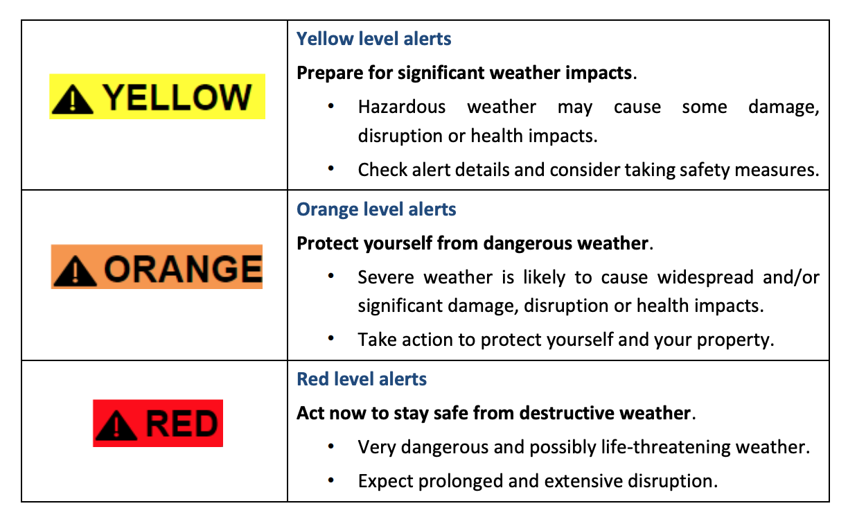
What is a blizzard?
In Canada, blizzard conditions are officially defined as a combination of strong winds and blowing snow that severely reduces visibility.
Environment Canada considers blizzard criteria to be met when sustained winds or frequent gusts of at least 40 km/h combine with falling or blowing snow to reduce visibility to 400 metres or less. These conditions must persist for at least four consecutive hours to be classified as a blizzard.
It is important to note that blizzard conditions are based on visibility and wind, not snowfall amounts, meaning they can occur even with relatively light snowfall if winds are strong enough to cause widespread blowing and drifting snow.
Surrounding areas may also see periods of blizzard conditions, including London, Tillsonburg, Woodstock, Kitchener, Newmarket, Oshawa and Orillia. Confidence is slightly lower in these locations due to their distance from the core lake effect bands, but brief or localized blizzard conditions remain fairly likely.
Across Southwestern Ontario, including Windsor, Chatham and Sarnia, localized blizzard conditions are possible for a few hours Monday morning as heavier system snow moves through. Similar brief conditions could develop in the Niagara region and the outer Golden Horseshoe, where strong winds overlap with bursts of snow.
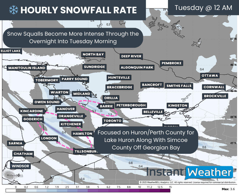
Hourly snowfall rates (cm) - MAP FROM WEATHERBELL
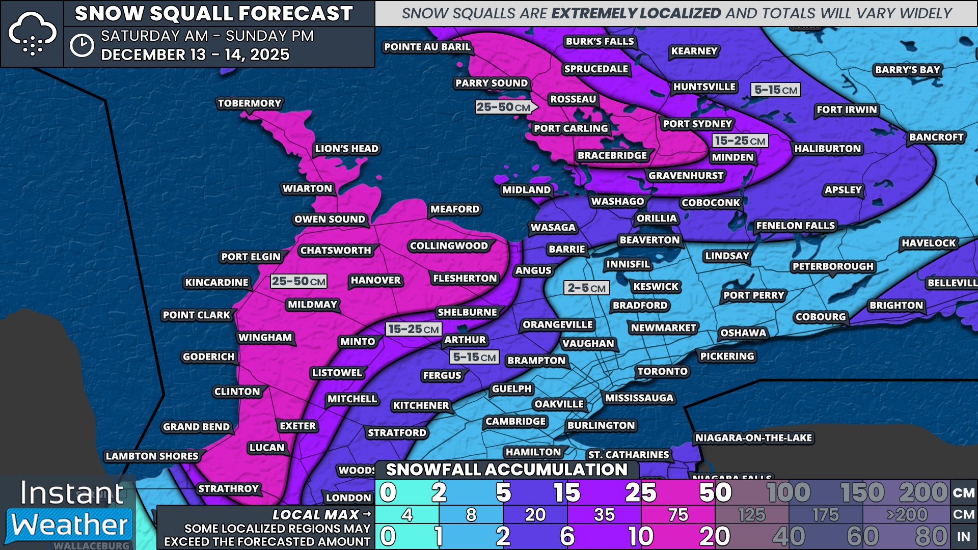
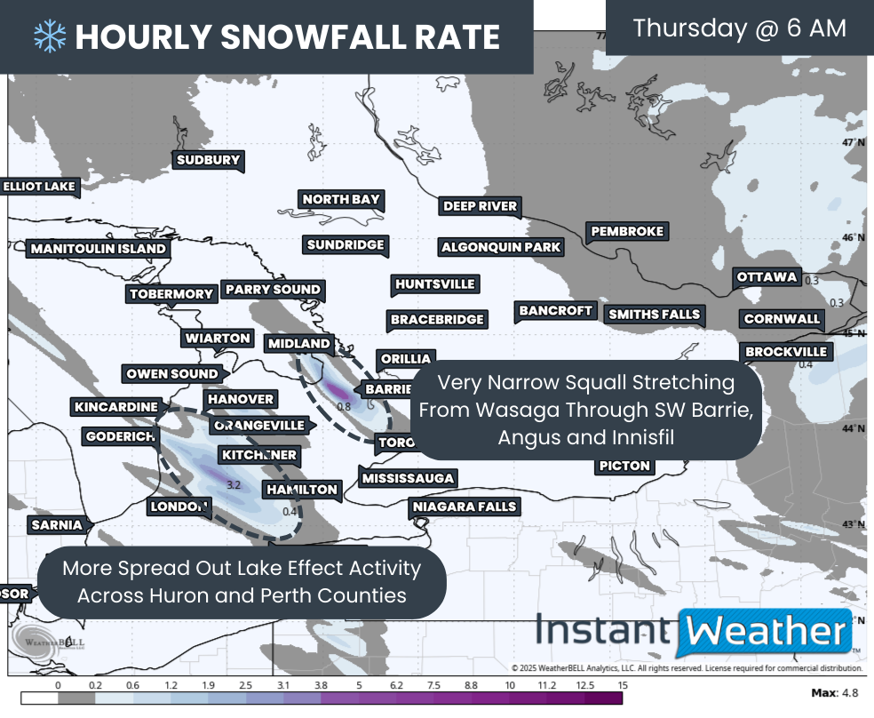
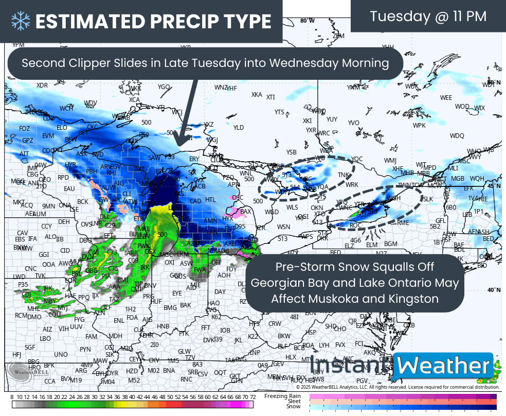
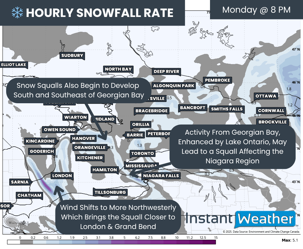
Overnight Monday into Tuesday morning, persistent snow squalls are expected to become established. One squall off Lake Huron may stretch through parts of Huron and Perth counties and at times reach into Woodstock and Brantford.
The Georgian Bay snow squall is expected to focus on the Collingwood to Barrie corridor and may occasionally extend into portions of York and Durham Region. These squalls may remain relatively locked in place through the night and morning hours, allowing snow to accumulate quickly as temperatures fall and accumulation efficiency increases.
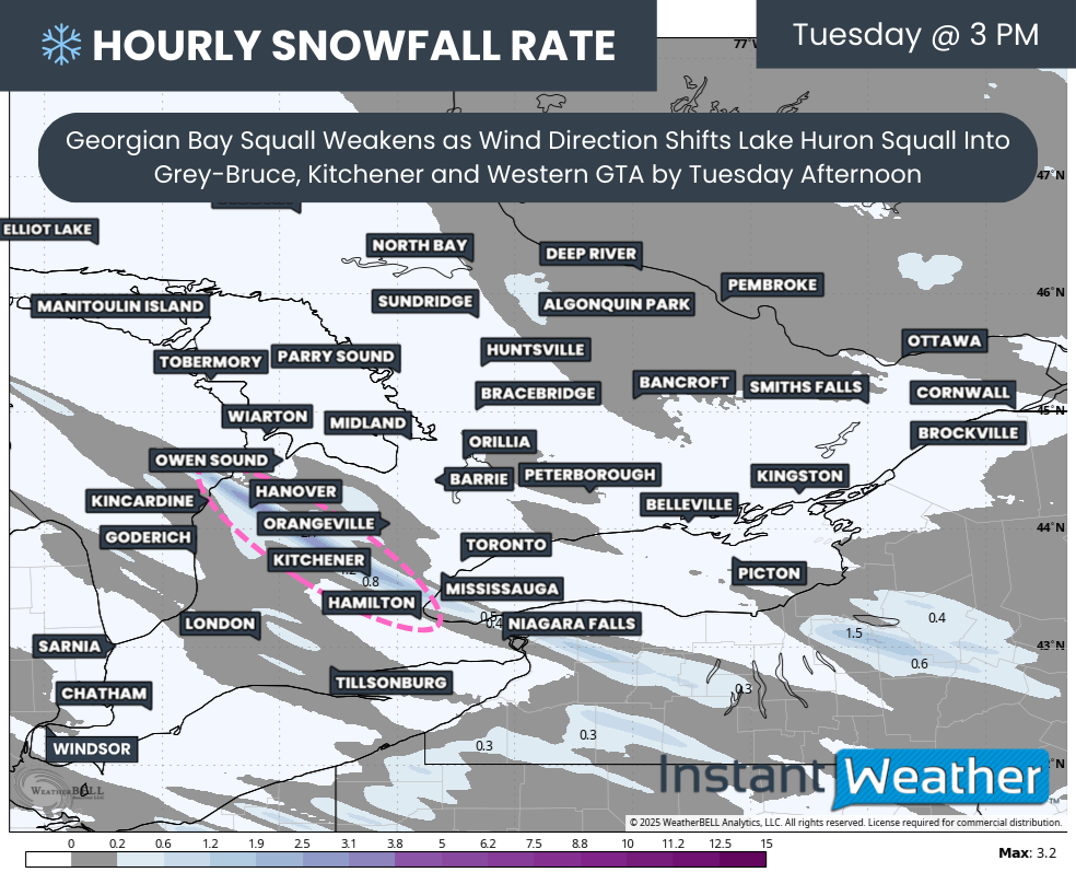
Hourly snowfall rates (cm) - MAP FROM WEATHERBELL
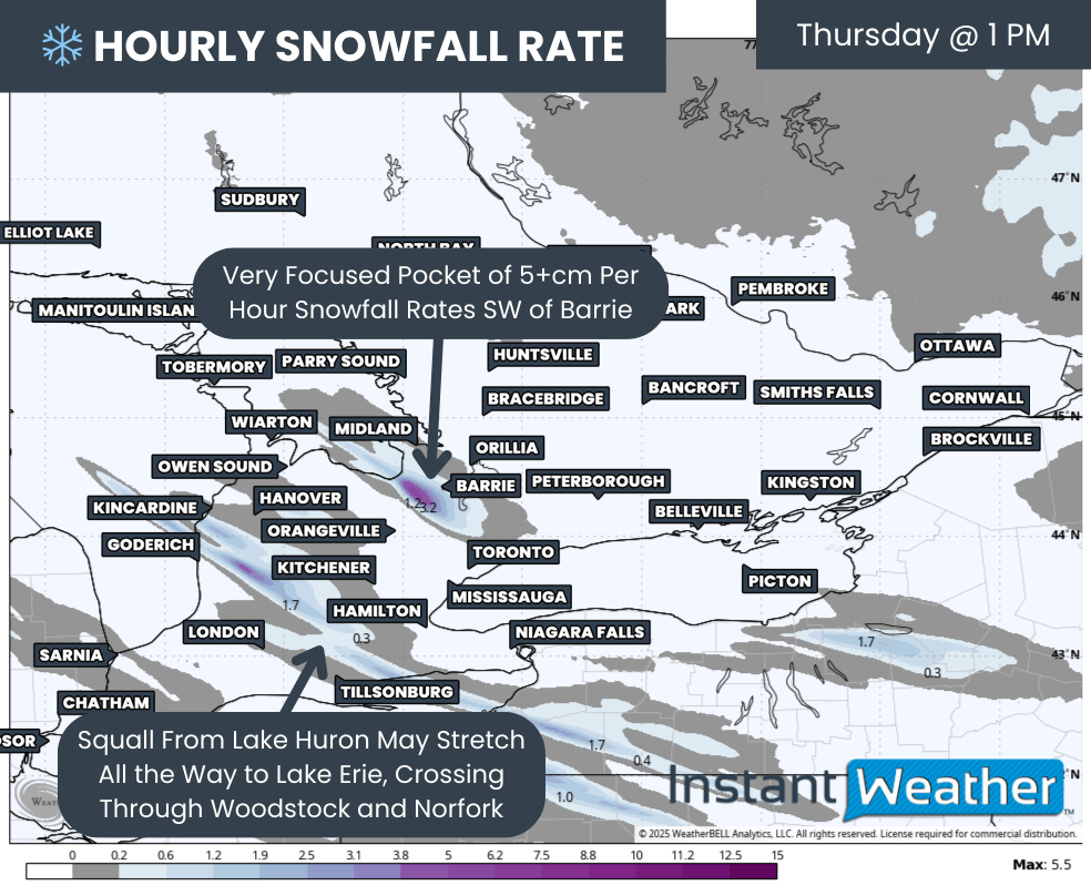
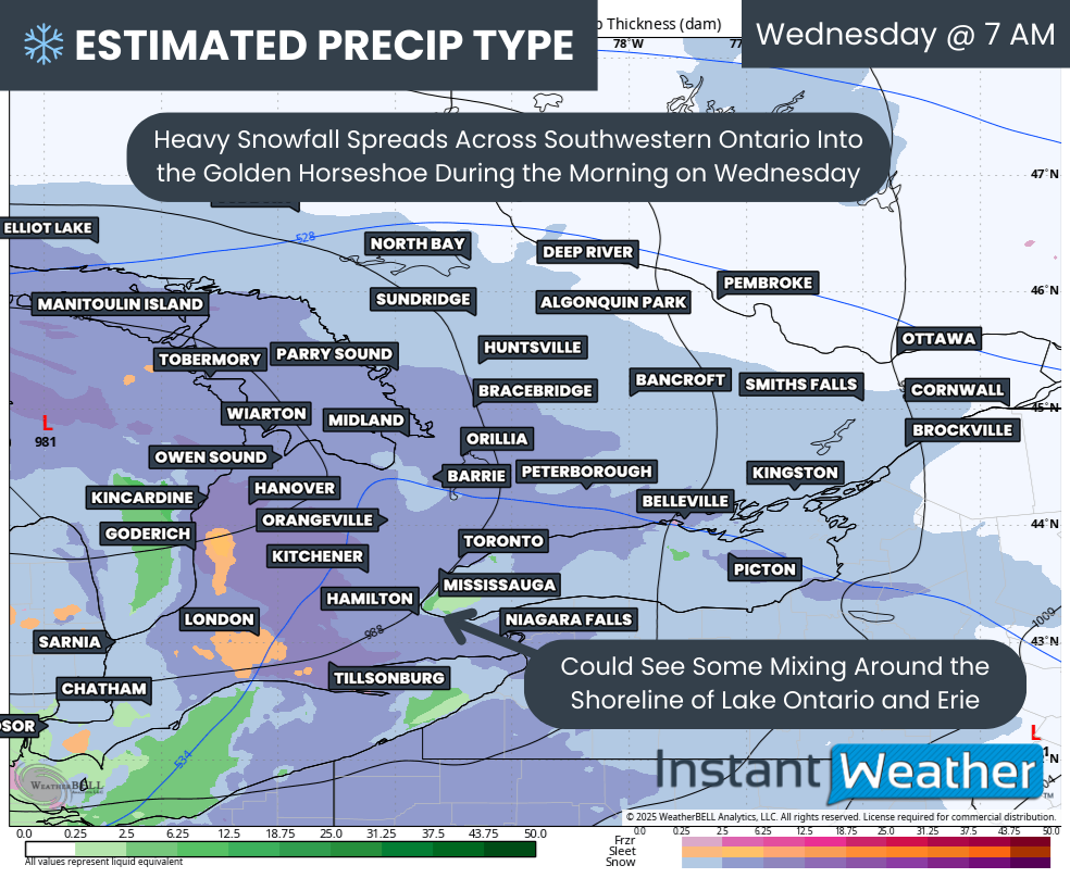
By Tuesday afternoon, a shift in wind direction is expected to weaken the Georgian Bay squall. The Lake Huron squall will likely become dominant and gradually drift northward, stretching from Hanover through Kitchener and into the western GTA.
This northward drift is expected to continue into Tuesday evening, while a new squall may redevelop farther south, again focusing on Huron and Perth counties and extending toward Kitchener and Hamilton Tuesday night.
Although this forecast period ends Tuesday evening, snow squalls are expected to persist into Wednesday, with activity becoming more focused on Grey-Bruce. A separate forecast will be issued to cover conditions beyond Tuesday.
NOTE: YOU CAN CLICK ON THE MAP TO OPEN A ZOOMABLE IMAGE

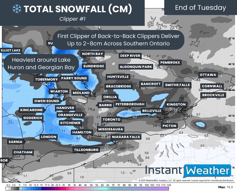
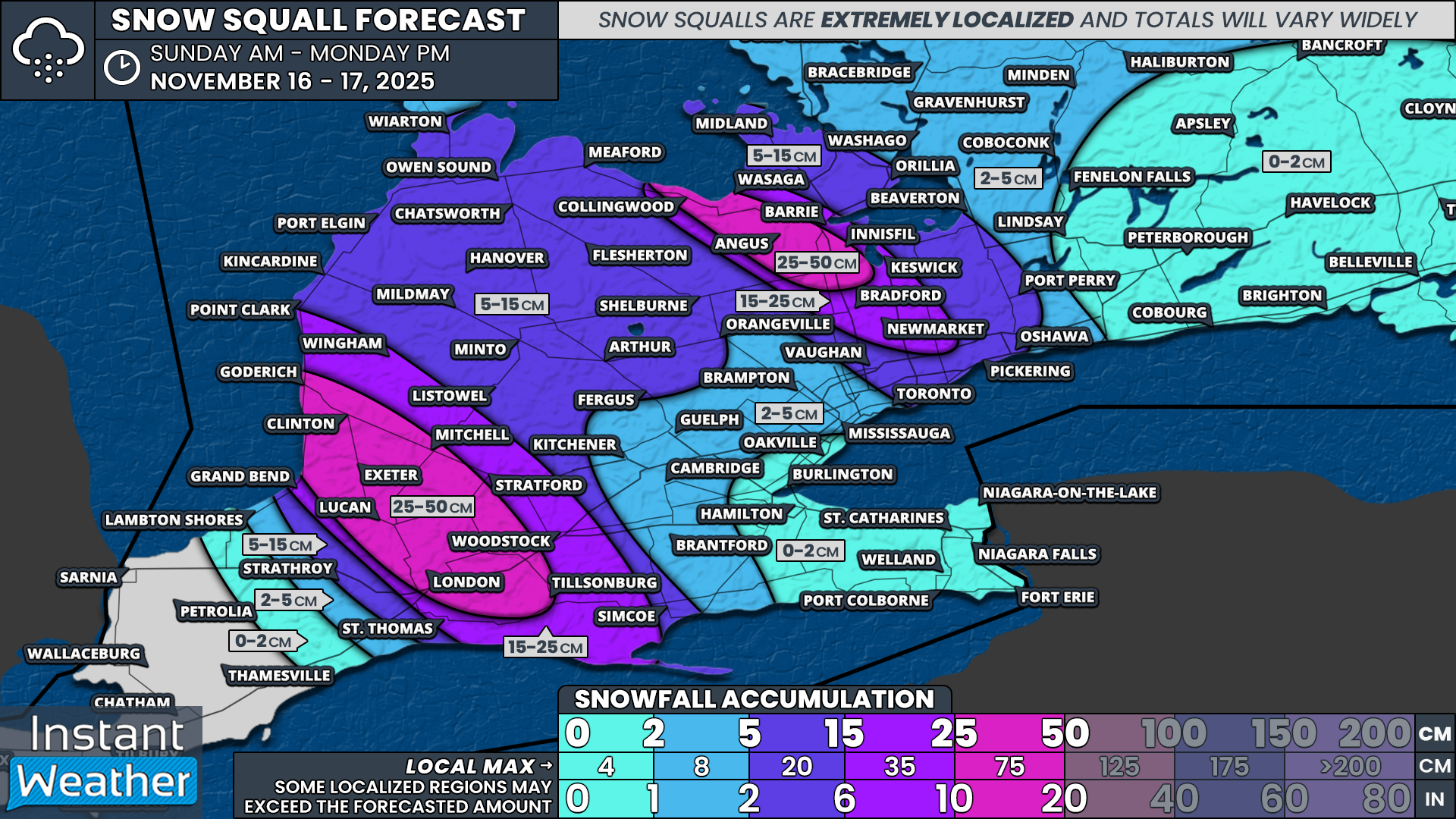
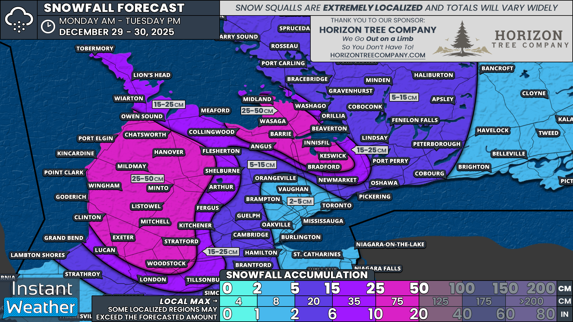
Given the meandering nature of the snow squalls east of Lake Huron, no single location is expected to dramatically outpace others in snowfall. Instead, widespread totals will be spread across communities such as Port Elgin, Chatsworth, Hanover, Flesherton, Kincardine, Mildmay, Minto, Point Clark, Wingham, Goderich, Listowel, Mitchell, Clinton, Exeter and Woodstock.
Snowfall totals in these areas are generally expected to range from 25 to 50 cm by the end of Tuesday. Similar totals of 25 to 50 cm are also likely for locations southeast of Georgian Bay, including Collingwood, Wasaga Beach, Barrie, Angus, Innisfil and Keswick.
Areas just outside the core lake effect zones, such as Grand Bend, London, Fergus, Arthur, Meaford, Owen Sound, Wiarton, Lion’s Head, Tobermory, Bradford and Orillia, are expected to see lower totals. These areas are generally looking at 15 to 25 cm of snow, though small shifts in wind direction could easily bring heavier snowfall into these communities.
For the remainder of Southwestern and Central Ontario, snowfall totals are expected to range from 5 to 15 cm. Most of this snow will fall early Monday with the system itself, followed by occasional lake effect snow through Tuesday.
Deep Southwestern Ontario, much of the GTA, the Niagara region and Eastern Ontario are expected to see less than 5 cm of snow overall. Despite lower accumulations, strong winds and brief bursts of snow could still lead to poor travel conditions at times.