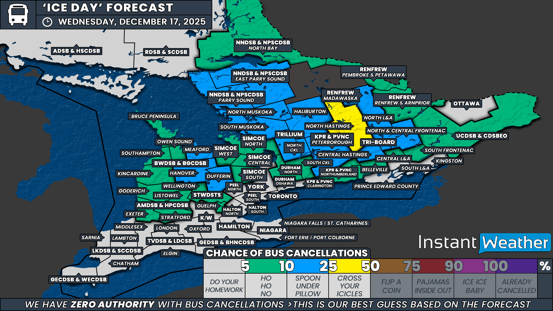
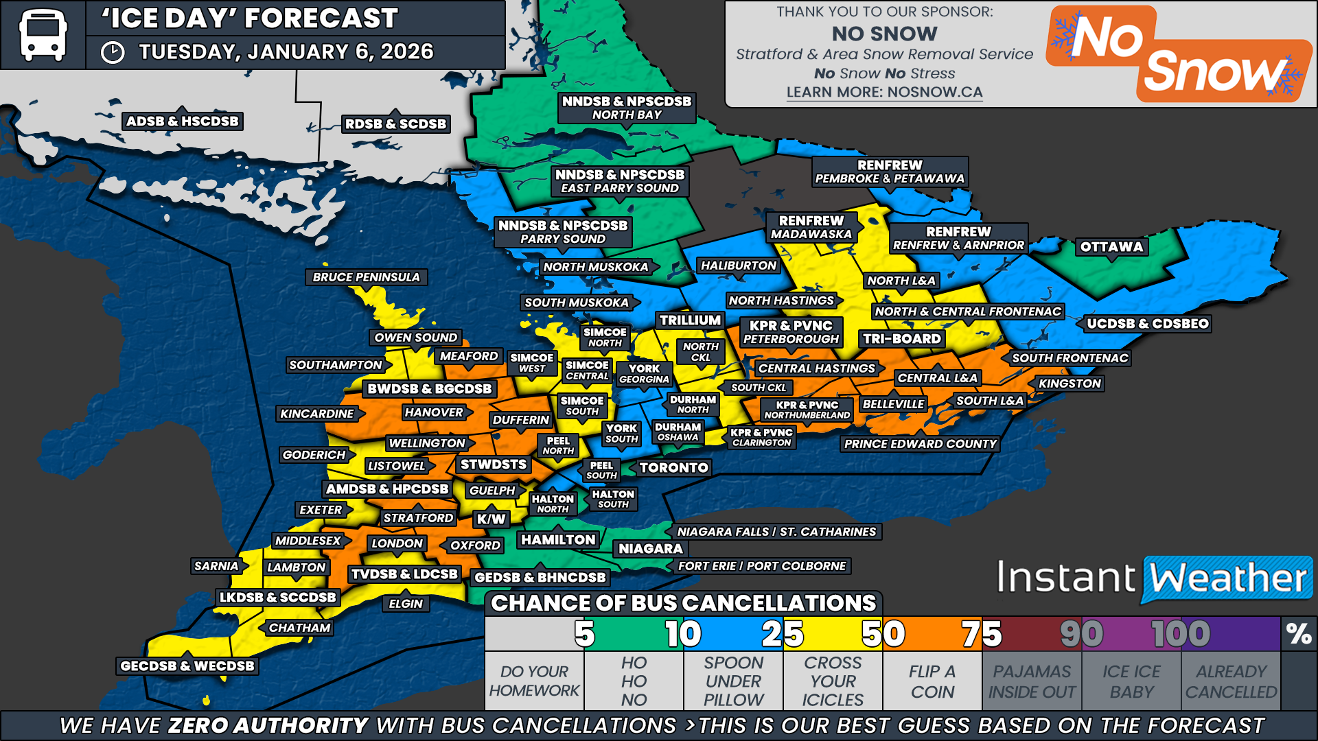
‘Snow (Ice) Day’ Forecast: Risk of Freezing Rain on Tuesday Could Cancel School Buses in Parts of Southern Ontario
/

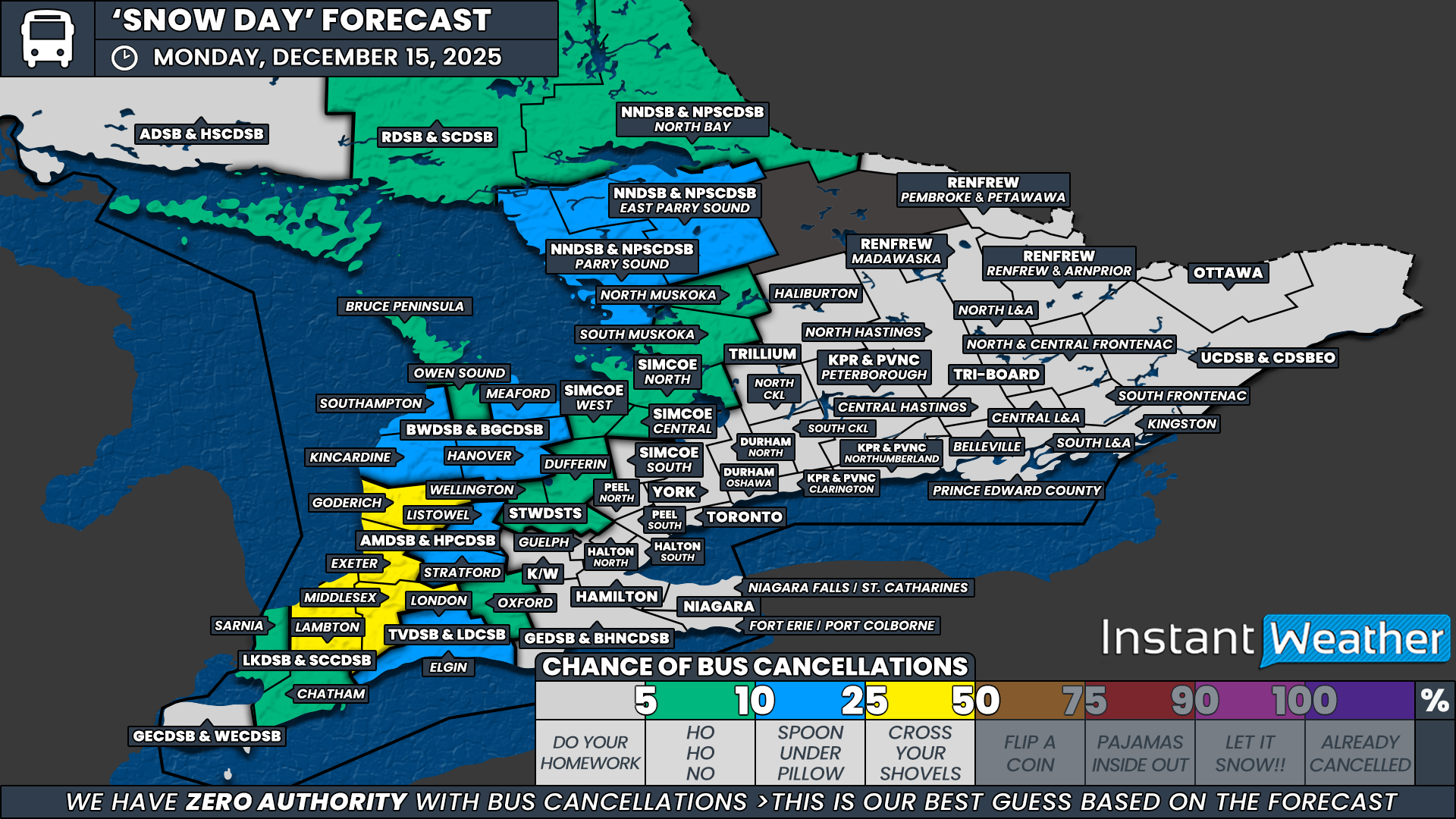
NOTE: YOU CAN CLICK ON THE MAP TO OPEN A ZOOMABLE IMAGE
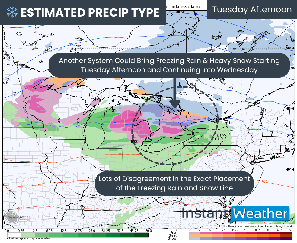
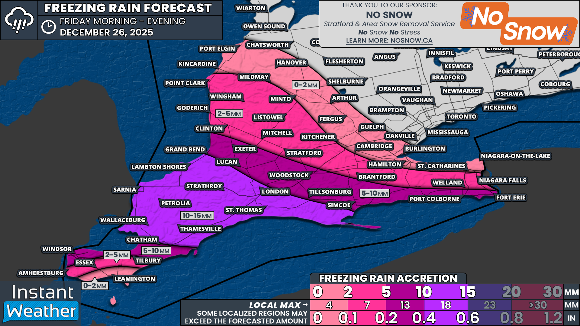
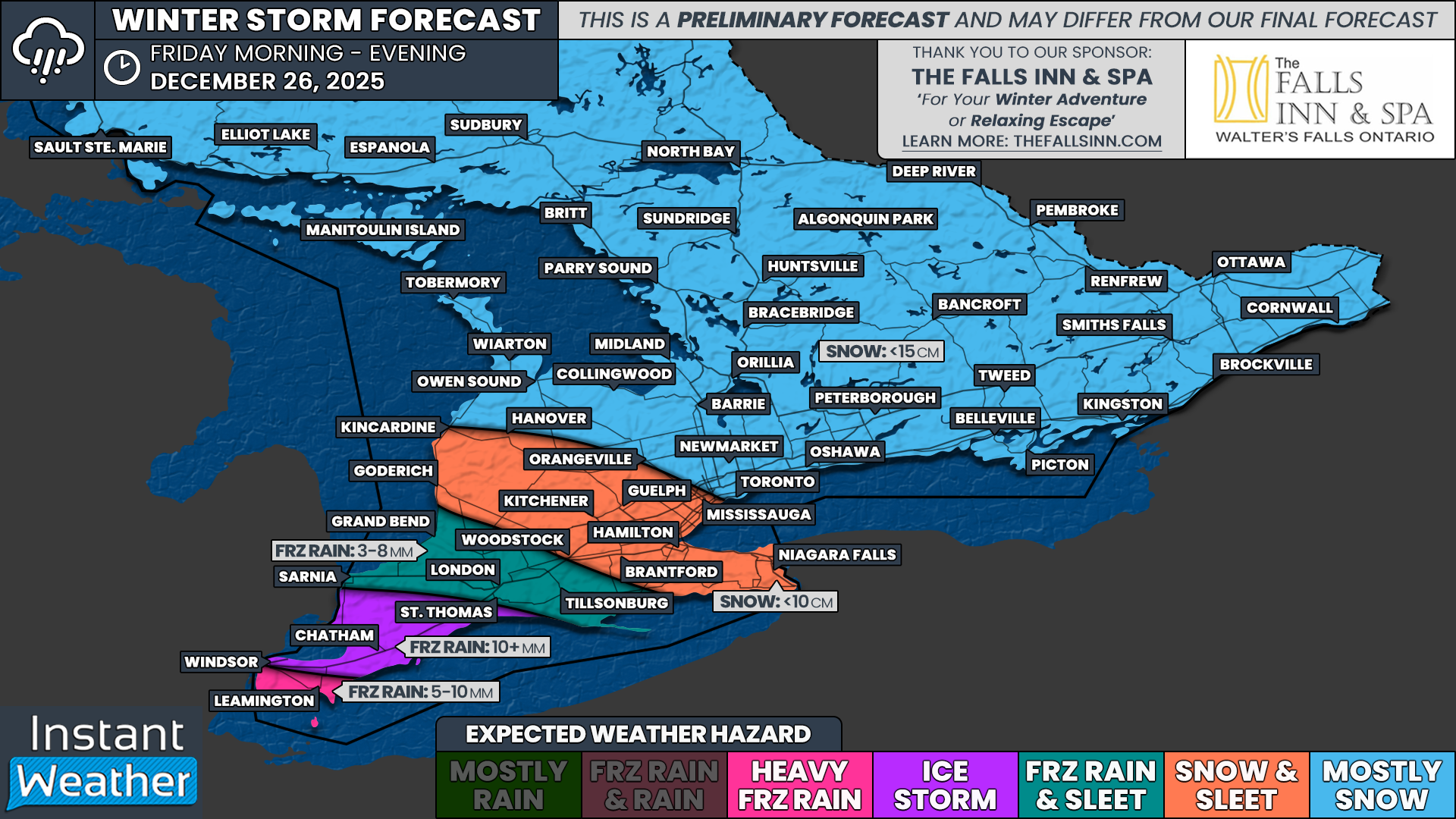
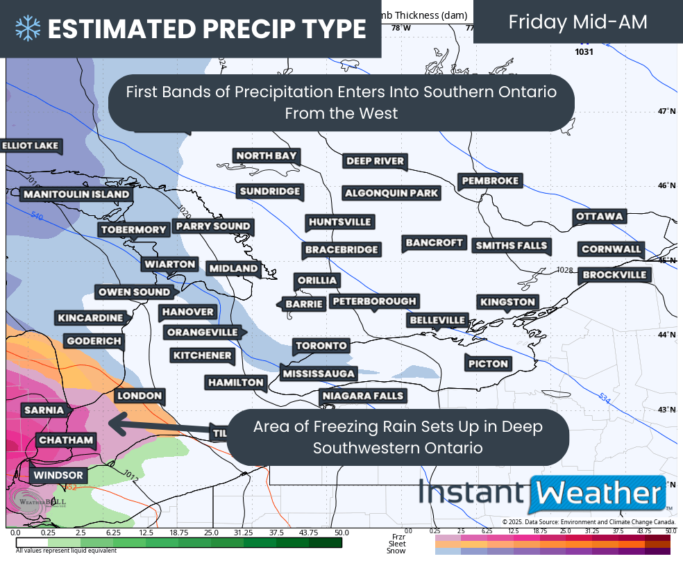
A messy and potentially disruptive system is expected to move through Southern Ontario on Tuesday, bringing with it the risk of several hours of freezing rain developing from the late morning into the afternoon.
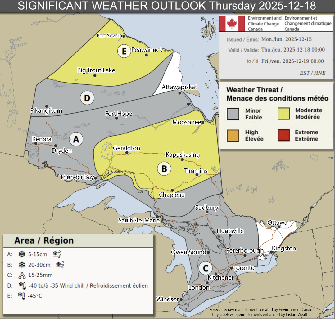
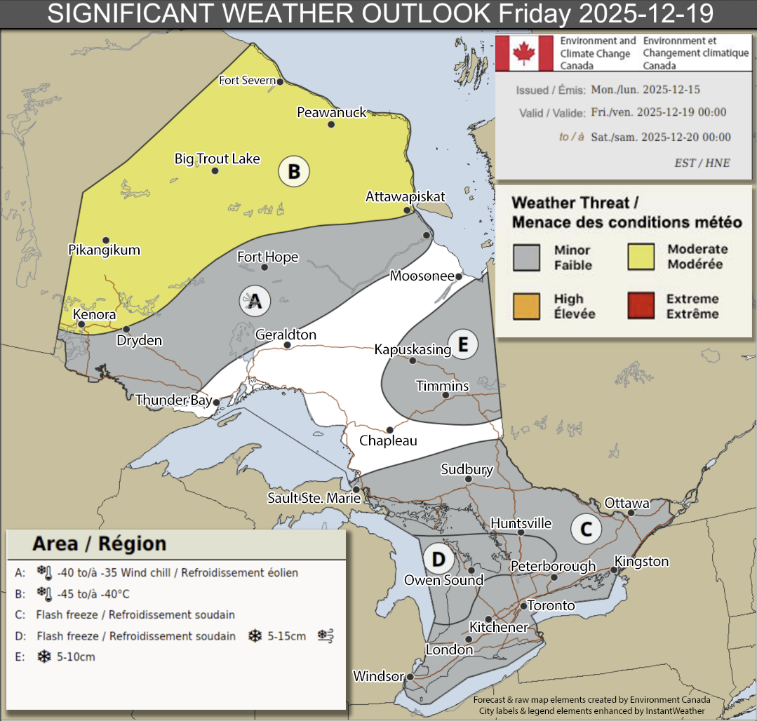
Environment Canada has issued widespread freezing rain warnings and special weather statements ahead of this system, highlighting the threat of icing beginning Tuesday morning and continuing through much of the day. With freezing rain notoriously difficult to deal with on untreated surfaces, there is growing concern that some school boards may opt to cancel buses, particularly across rural areas northwest of the Greater Toronto Area and into portions of Central and Eastern Ontario.
What makes this event especially tricky from a school transportation perspective is the timing. The bulk of the freezing rain is not expected to begin until after the morning bus run has already wrapped up. That means any cancellations would need to be made proactively, based largely on Environment Canada alerts and the expectation of deteriorating conditions during the afternoon dismissal. Historically, that level of proactiveness can vary quite a bit from one school board to another.
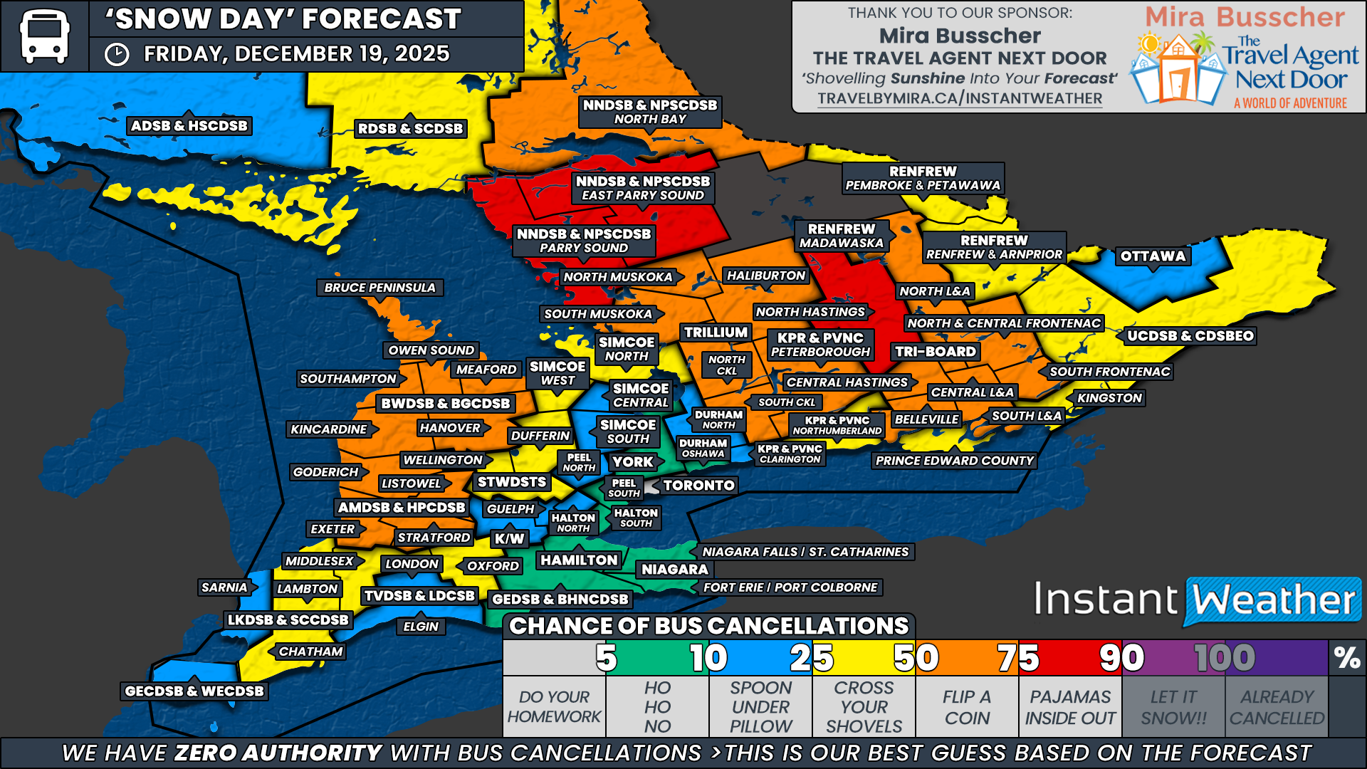
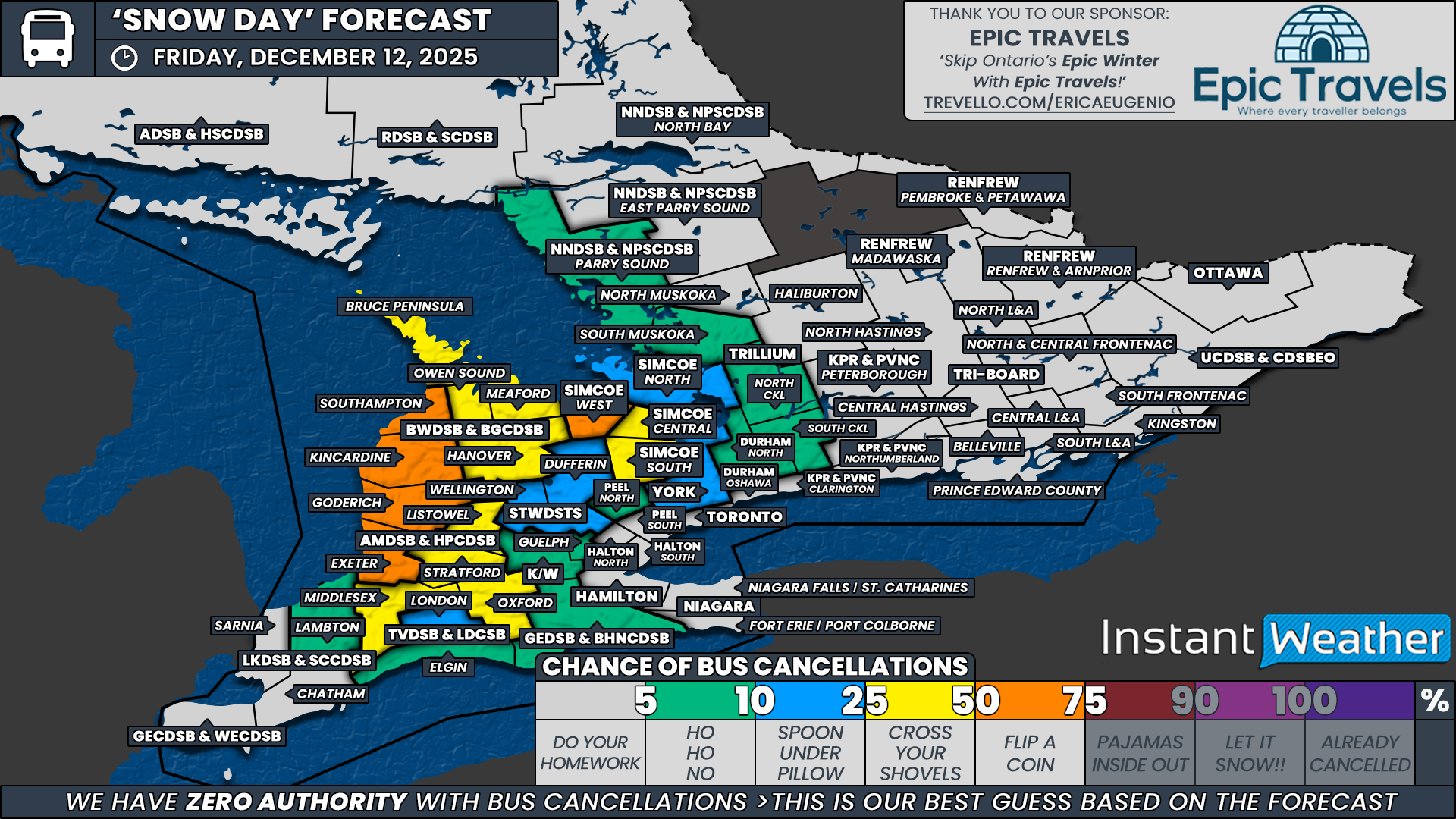
Because of that uncertainty, we have capped the highest probability at 50 percent, reflecting the fact that this could truly go either way. This 50 percent zone includes Middlesex and Oxford counties under the Thames Valley District School Board, Perth County within the Avon Maitland District School Board, Wellington and Dufferin counties for the Upper Grand District School Board, and the Kincardine, Hanover and Meaford regions under the Bluewater District School Board. These areas are more rural in nature, tend to respond more cautiously to freezing rain threats, and are currently covered by freezing rain warnings. While no single region stands out as a sure thing for cancellations, we do have fairly strong confidence that at least a few boards will declare an “ice day” on Tuesday.
We have also included Peterborough and Northumberland counties under the Kawartha Pine Ridge District School Board, along with the southern portions of Tri-Board Student Transportation Services, in the 50 percent category. These areas are currently under special weather statements rather than full warnings, but these school boards have a history of being particularly proactive when freezing rain is involved. In some cases, even a special weather statement can be enough to prompt cancellations.
A broader area has been assigned a 25 percent chance, covering much of Southwestern Ontario and extending into parts of Central and Eastern Ontario. This includes the Greater Essex County District School Board, the Lambton Kent District School Board, London and Elgin County within the Thames Valley District School Board, Huron County under the Avon Maitland District School Board, Owen Sound, Southampton and the Bruce Peninsula for the Bluewater District School Board, Waterloo Region, Guelph under the Upper Grand District School Board, the Simcoe County District School Board, North and South Kawartha Lakes under the Trillium Lakelands District School Board, and the remaining portions of Tri-Board. In these areas, freezing rain is either expected to be patchy or brief, but given the timing and potential for slick roads, a few surprise cancellations cannot be ruled out.
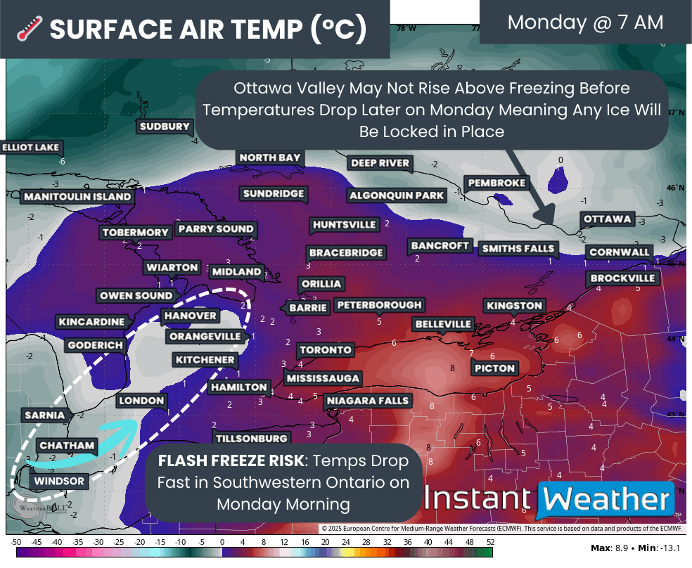
Outside of this zone, including the more urban school boards across the Golden Horseshoe, the Ottawa Valley and Northeastern Ontario, the chance of school bus cancellations drops to low or very low. In some cases, these regions are simply too far removed from the core freezing rain threat, as is the case for parts of Northeastern Ontario and the Ottawa Valley. In other cases, the boards are highly urbanized and typically require more widespread or severe icing before cancellations are considered.
Disclaimer: Instant Weather has zero authority when it comes to bus and school closures.
It is completely up to the school boards, bus companies, local authorities, and parents to decide what is best for their children. This is our best guess based on our forecast.